Description
Pardies, Ignace Gaston Himmelskugel in sechs Karten abgebildet, aus dem Lateinischen zum Gebrauch der Schuliugend um die Astrognosie zu erlernen übersetzet durch Georg Friederich Kordenbusch. Mit 6 ko…
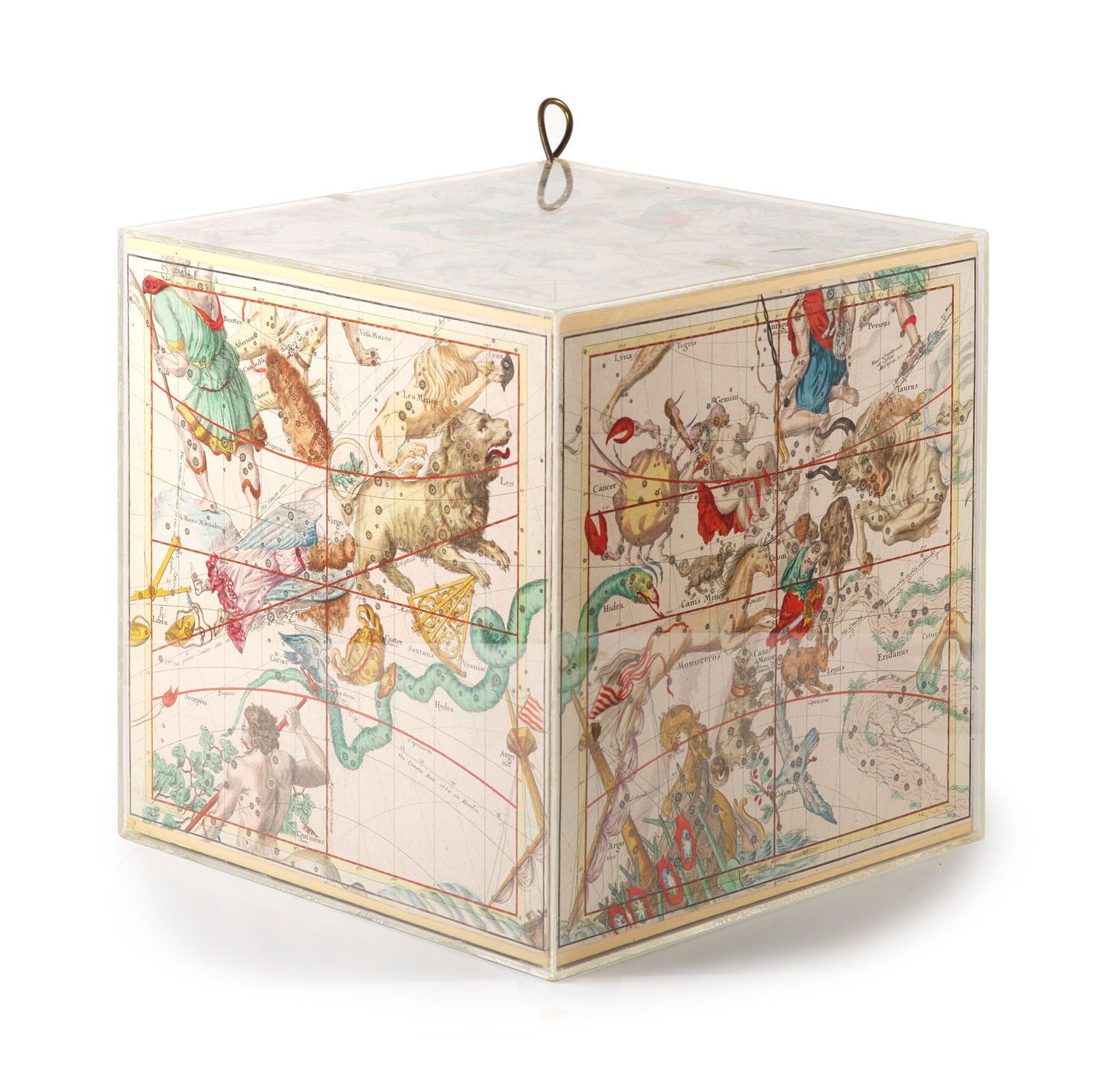
Astronomy Pardies, Ignace Gaston Celestial sphere illustrated in six maps, translated from Latin by Georg Friederich Kordenbusch for the use of schoolchildren to learn astronomy. With 6 colored engraved maps mounted on cardboard in a Plexiglas cube. Nuremberg, Chr. Weigel and A.G. Schneider, 1789. 2 pp., 8 p. 4°. Bound. VD18 13395068. - DSB X, 315 - Warner, Sky explored, 196 - De Backer-Sommervogel VI, 203, 14 - Cf. Brown, Astronomical Atlasses, 36f - Pardies' first edition "Globi coelestis in tabulas planas redacti descriptio" was published posthumously in Paris in 1673. In Germany, the maps were first published in Köhler's "Bequemen Schul- und Reisen-Atlas" in 1719. - "His maps seem to have been little known outside France, and not generally used by astronomers. The 'Globi Coelestis' consisted of six double-page maps, with notes at the sides to indicate the positions of the stars. There were three editions, all are very rare ... The rare maps of Pardies are distinguished by the distinctness with which the individual stars are shown, and the masterly imaginative representation of the constellation figures a high standard of artistic ability." (Brown). - Very rare. Only 2 copies in WorldCat, no copy in international trade. - Title and 1st leaf of the supplement with backing in w. margin, slightly stained, 3 leaves with crease. - The 6 maps (each approx. 36 x 36 cm) in strong coloring with constellations and comet orbits. - Trimmed beyond the framing line and with smoothed centerfold, one of which with small added corner tear, one with small tears in the lower margin, two in the outer margin somewhat glue-shadowed. Astronomy - With 6 colored engraved maps mounted on cardboard in a Plexiglas cube. Unbound. - Pardies' first edition "Globi coelestis in tabulas planas redacti descriptio" appeared posthumously in Paris in 1673. In Germany, the maps were first published in Köhler's "Bequemen Schul- und Reisen-Atlas" in 1719. - "His maps seem to have been little known outside France, and not generally used by astronomers. The 'Globi Coelestis' consisted of six double-page maps, with notes at the sides to indicate the positions of the stars. There were three editions, all are very rare ... The rare maps of Pardies are distinguished by the distinctness with which the individual stars are shown, and the masterly imaginative representation of the constellation figures a high standard of artistic ability." (Brown). - Very rare. Only 2 copies in WorldCat, no copy in international trade. - Title and 1st leaf of the supplement with backing in the white margin, a little stained, 3 leaves creased. - The 6 maps (each c. 36 x 36 cm) in strong coloring with constellations and comet orbits. - Trimmed beyond the border line and with smoothed centerfold, one of them with a small supplemented corner tear, one with small defects in the lower margin, two in the outer margin somewhat shaded with glue.
525
Pardies, Ignace Gaston Himmelskugel in sechs Karten abgebildet, aus dem Lateinischen zum Gebrauch der Schuliugend um die Astrognosie zu erlernen übersetzet durch Georg Friederich Kordenbusch. Mit 6 kolorierten gestochenen, auf Karton in einen Plexiglas-K