Description
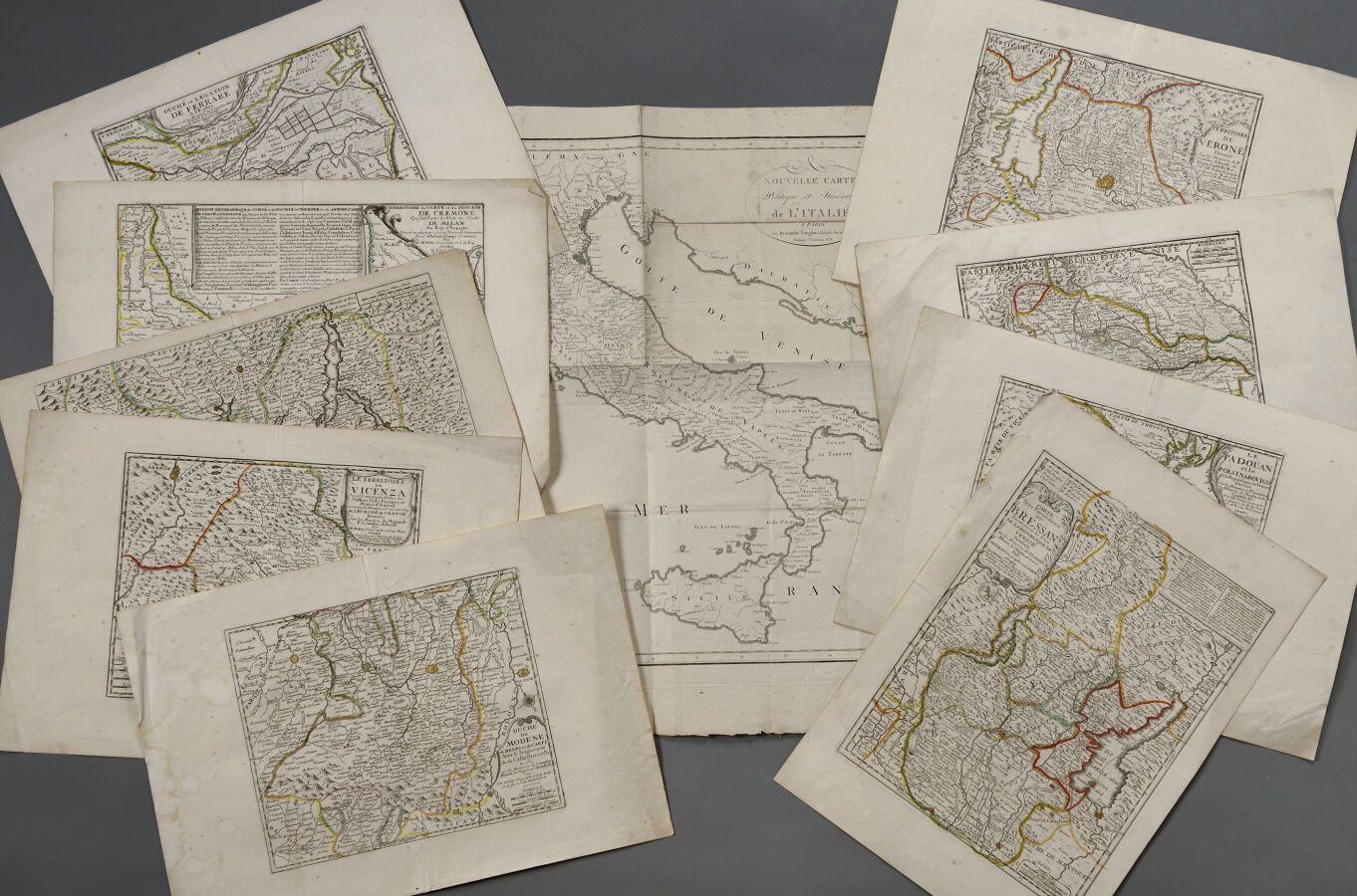
Jean-Baptiste NOLIN (1657 - 1708) Lot of nine maps related to Northern Italy including: The Duchy of Modena, The Paduan, The Duchy of Mantua, Map of the Bressan, Map of the territory of Vicennal, Map of the territory of Verona, The Duchy of Ferrara, The County of Cremona and The Duchy of Milan. About 1700. The sheets: about H. 33 cm - L. 47 cm. Some defects, foxing, etc. A new political map and itinerary of Italy by Hyacinthe LANGLOIS is attached. The sheet : H. 62 cm - L. 55 cm. Emargée on the left. Defects, folded in four.
453
Jean-Baptiste NOLIN (1657 - 1708) Lot of nine maps related to Northern Italy including: The Duchy of Modena, The Paduan, The Duchy of Mantua, Map of the Bressan, Map of the territory of Vicennal, Map of the territory of Verona, The Duchy of Ferrara, The County of Cremona and The Duchy of Milan. About 1700. The sheets: about H. 33 cm - L. 47 cm. Some defects, foxing, etc. A new political map and itinerary of Italy by Hyacinthe LANGLOIS is attached. The sheet : H. 62 cm - L. 55 cm. Emargée on the left. Defects, folded in four.
You may also like