TASSIN (Christophe).
First part of the Plans and Profiles of all the main Cities and important places in France. Ensemble les Cartes généralles de chascunes Provinces et les particulières de chasque gouvernement d'icelles. S.l.n.d. [middle of the 17th century]. In-8 oblong, soft vellum, remains of laces, red edges (18th century binding).
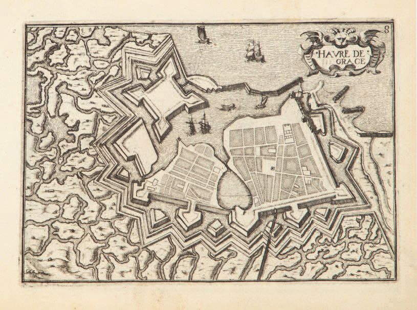
First part, out of two, of this important atlas drawn up by Christophe Tassin, geographer to King Louis XIII, constituting one of the most complete topographical tables of the kingdom of France in the 17th century.
The copy consists of an engraved title-frontispiece, a title of the provinces contained in this first part, a general map of France, and 190 plates, all engraved in intaglio. The 190 plates (titles in a cartouche, tables, views and plans) are divided into 6 series, each corresponding to a particular province: Picardy (46 plates), Champagne (54 plates), Brittany (28 plates), Normandy (27 plates), Île de France (18 plates) and Brie (17 plates).
Missing the series dedicated to Lorraine. Fading in brown ink on the allegorical figure of the frontispiece. Small worm gallery in the inner margin of some plates, small repair without gravity to the plate of the castle of Brest, wetness to the plates of the series on the country of Brie.