Description
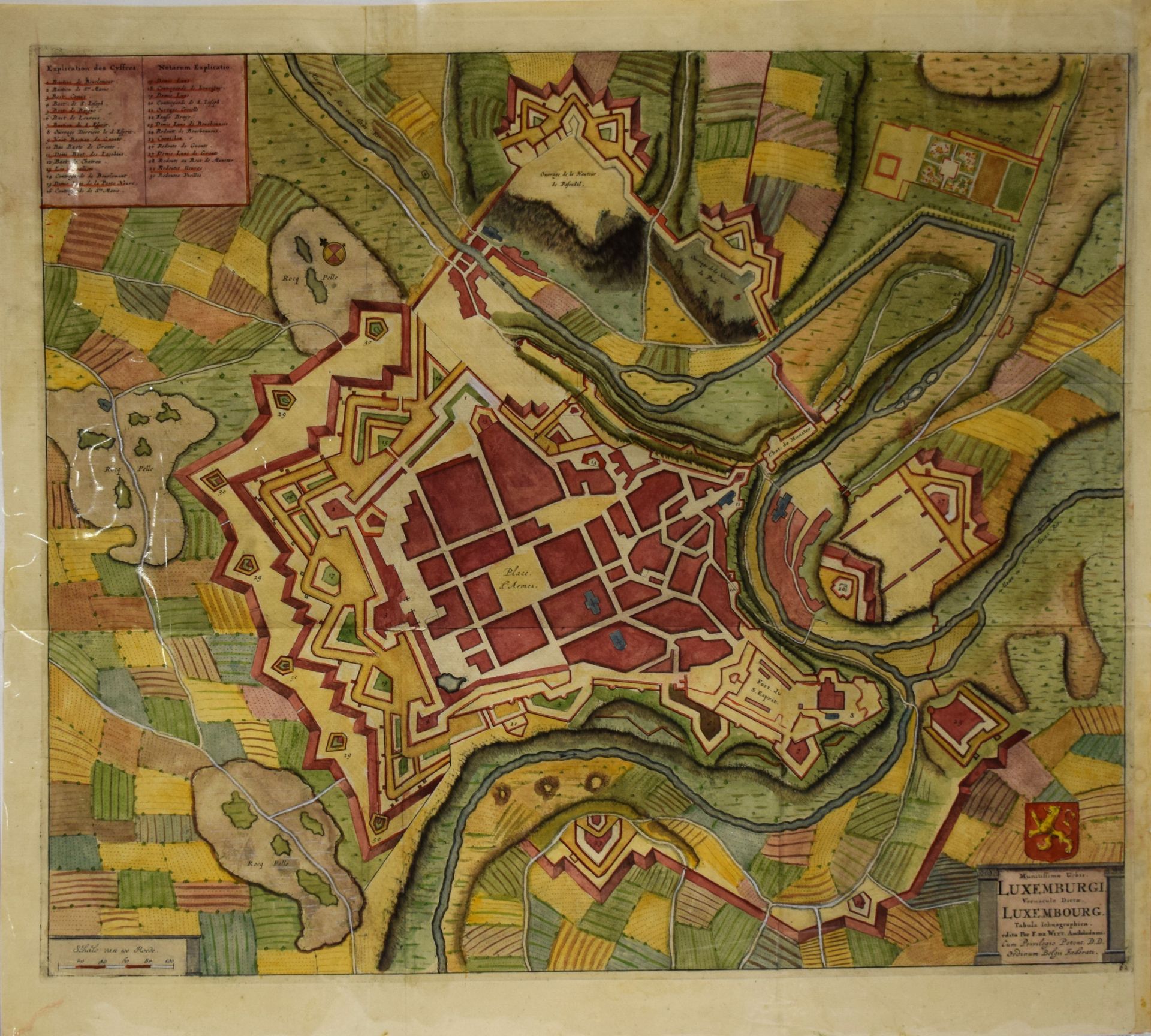
(PLAN) Map of the city of Luxembourg "Munitissimae Urbis. Luxemburgi. Vernacula Dictae. Luxembourg. Tabula Ichnographica", by Frederik de WIT, ca 1690/95, entirely watercolored, 56 x 62 cm (one of the first plans including the new fortifications added by VAUBAN) [Emile Van Der Vekene : Les plans de la ville et forteresse de Luxembourg - 20.23]
550
(PLAN) Map of the city of Luxembourg "Munitissimae Urbis. Luxemburgi. Vernacula Dictae. Luxembourg. Tabula Ichnographica", by Frederik de WIT, ca 1690/95, entirely watercolored, 56 x 62 cm (one of the first plans including the new fortifications added by VAUBAN) [Emile Van Der Vekene : Les plans de la ville et forteresse de Luxembourg - 20.23]