Description
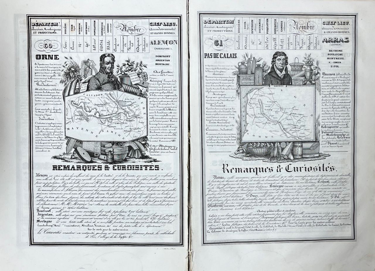
J. HENRY / G. FISQUET / A. MARTINEAU - Lot of 4 atlases XIXth or XXth c. - J. HENRY - Nouvelle géographie et statistique de la France, Alger et la Belgique, suivie d'un Traité sur le monde entier. 5th edition revised, corrected and enlarged by Alexandre Corbin. [And:] Histoire de France, depuis Pharamond jusqu'à Louis-Philippe Ier (420-1842). Tours, Alexandre Corbin, 1842. 2 works bound in 1 volume in-folio, contemporary half-basane (binding damaged, ex. disconnected). [3 (3 litho. title)], [45], [2], [1]; [18] ff. The 86 departments are each illustrated with a map in the text. 1 itinerary map of France, 1 fold-out map of the five parts of the world, 1 fold-out map of the whole world, a map of Belgium (on the back of the f. concerning Belgium). - G. FISQUET - Large departmental atlas of France, Algeria and the colonies. 106 maps engraved on copper by G. Lorsignol. Paris, A. Le Vasseur, s.d. 2 parts bound in 2 volumes in-folio in the Italian style, half green chagrin edition cardboard. 1st part: Department. 2nd part: Algeria - French Colonies. Statistical and biographical tables. Repeated pagination. Missing map n° 3 (general map of France). - A. MARTINEAU - New illustrated atlas. Universal geography including geography, history, administration, statistics, etc. Paris, 1892. In-folio, publisher's red half-chagrin binding (worn binding, spines cracked). 64 (of 65) color maps mounted on tabs and a large folding map of railroads at the end of the book. Missing map 36 of Germany. - A. MARTINEAU and H. STEIN - New illustrated atlas. France and its colonies. One hundred and twenty-one maps. Paris, 1900. In-folio, red half-chagrin edition cardboard (spines split). 2 maps are folding. Includes maps 53 bis and 67 bis. TOGETHER 5 VOLUMES, BINDINGS WORN AND DAMAGED.
457
J. HENRY / G. FISQUET / A. MARTINEAU - Lot of 4 atlases XIXth or XXth c. - J. HENRY - Nouvelle géographie et statistique de la France, Alger et la Belgique, suivie d'un Traité sur le monde entier. 5th edition revised, corrected and enlarged by Alexandre Corbin. [And:] Histoire de France, depuis Pharamond jusqu'à Louis-Philippe Ier (420-1842). Tours, Alexandre Corbin, 1842. 2 works bound in 1 volume in-folio, contemporary half-basane (binding damaged, ex. disconnected). [3 (3 litho. title)], [45], [2], [1]; [18] ff. The 86 departments are each illustrated with a map in the text. 1 itinerary map of France, 1 fold-out map of the five parts of the world, 1 fold-out map of the whole world, a map of Belgium (on the back of the f. concerning Belgium). - G. FISQUET - Large departmental atlas of France, Algeria and the colonies. 106 maps engraved on copper by G. Lorsignol. Paris, A. Le Vasseur, s.d. 2 parts bound in 2 volumes in-folio in the Italian style, half green chagrin edition cardboard. 1st part: Department. 2nd part: Algeria - French Colonies. Statistical and biographical tables. Repeated pagination. Missing map n° 3 (general map of France). - A. MARTINEAU - New illustrated atlas. Universal geography including geography, history, administration, statistics, etc. Paris, 1892. In-folio, publisher's red half-chagrin binding (worn binding, spines cracked). 64 (of 65) color maps mounted on tabs and a large folding map of railroads at the end of the book. Missing map 36 of Germany. - A. MARTINEAU and H. STEIN - New illustrated atlas. France and its colonies. One hundred and twenty-one maps. Paris, 1900. In-folio, red half-chagrin edition cardboard (spines split). 2 maps are folding. Includes maps 53 bis and 67 bis. TOGETHER 5 VOLUMES, BINDINGS WORN AND DAMAGED.