Description
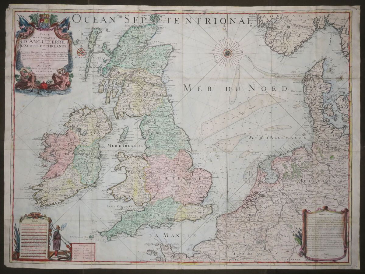
UNITED KINGDOM & NORTH SEA - "MAP (MARINE) of the Kingdoms of ENGLAND, SCOTLAND and IRELAND with the sea-coasts of France, Holland, Germany, Denmark and Norway which surround the North Sea, where are marked the Banks and Soundings &c. Dressée, sur plusieurs cartes particulierses, memoires, et autres faites sur les lieux; par Operations Geometriques, Gravée et Dediée Au Roy D'Angleterre D'Ecosse et d'Irlande", by Charles INSELIN. In Paris, at Mondhare and Jean de Beauvais n°4, 1793. Large engraved map, on laid paper. Colored. Nice title cartouche in the upper left corner. Margins. 65 x 88 cm. Condition A (some traces of handling and old folds, good general condition).
64
UNITED KINGDOM & NORTH SEA - "MAP (MARINE) of the Kingdoms of ENGLAND, SCOTLAND and IRELAND with the sea-coasts of France, Holland, Germany, Denmark and Norway which surround the North Sea, where are marked the Banks and Soundings &c. Dressée, sur plusieurs cartes particulierses, memoires, et autres faites sur les lieux; par Operations Geometriques, Gravée et Dediée Au Roy D'Angleterre D'Ecosse et d'Irlande", by Charles INSELIN. In Paris, at Mondhare and Jean de Beauvais n°4, 1793. Large engraved map, on laid paper. Colored. Nice title cartouche in the upper left corner. Margins. 65 x 88 cm. Condition A (some traces of handling and old folds, good general condition).