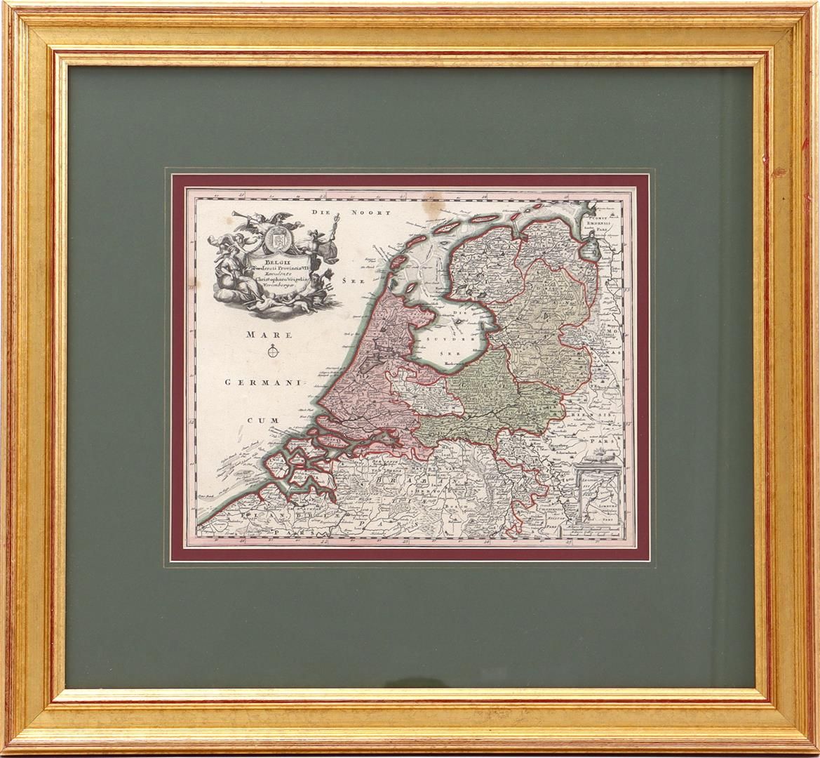
Framed topographical map of the VII provinces of the Netherlands/Belgium, by Christophoro Weigelio, situation ca. 1700, 27x34 cm, incl. frame in total 57x62 cm
We use cookies to provide you with a better browsing experience, perform site traffic analysis, and deliver content and advertisements most relevant to your interests.
Cookie management:
By allowing these cookies, you agree to the deposit, reading and use of tracking technologies necessary for their proper functioning. Read more about our privacy policy.