Description
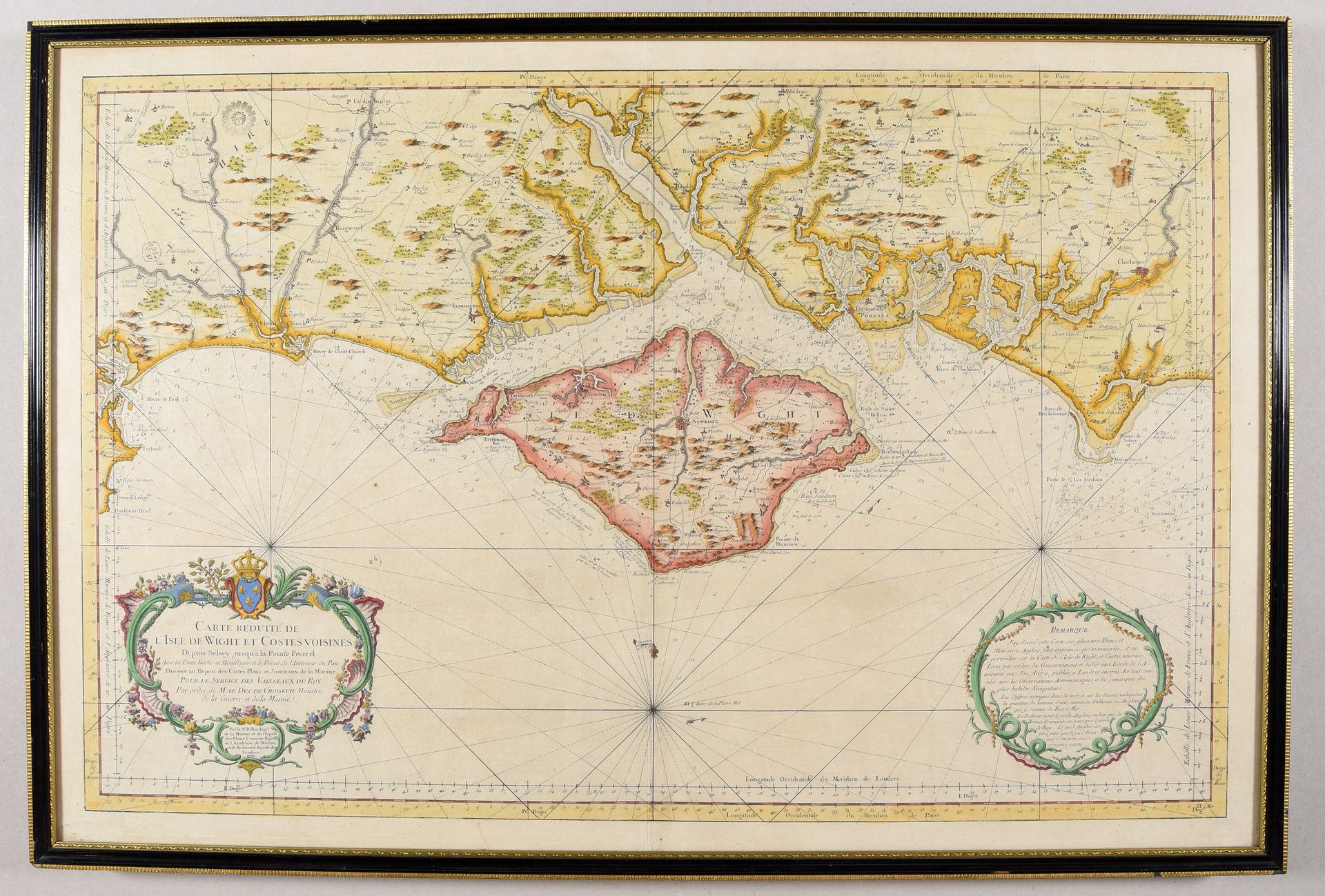
BELLIN, Jacques-Nicolas Carte réduite de l'Isle de Wight et costes voisines [...]. [Paris] 1762 Engr. 56 x 85.5 cm, old hand-colored (sm. defects). Framed (not studied outside frame). Rare nautical chart of the Solent separating the Isle of Wight from Great Britain. A precious tool, largely based on J. Avery's 1621 survey map, for the service of the king's vessels.
544
BELLIN, Jacques-Nicolas Carte réduite de l'Isle de Wight et costes voisines [...]. [Paris] 1762 Engr. 56 x 85.5 cm, old hand-colored (sm. defects). Framed (not studied outside frame). Rare nautical chart of the Solent separating the Isle of Wight from Great Britain. A precious tool, largely based on J. Avery's 1621 survey map, for the service of the king's vessels.