Description
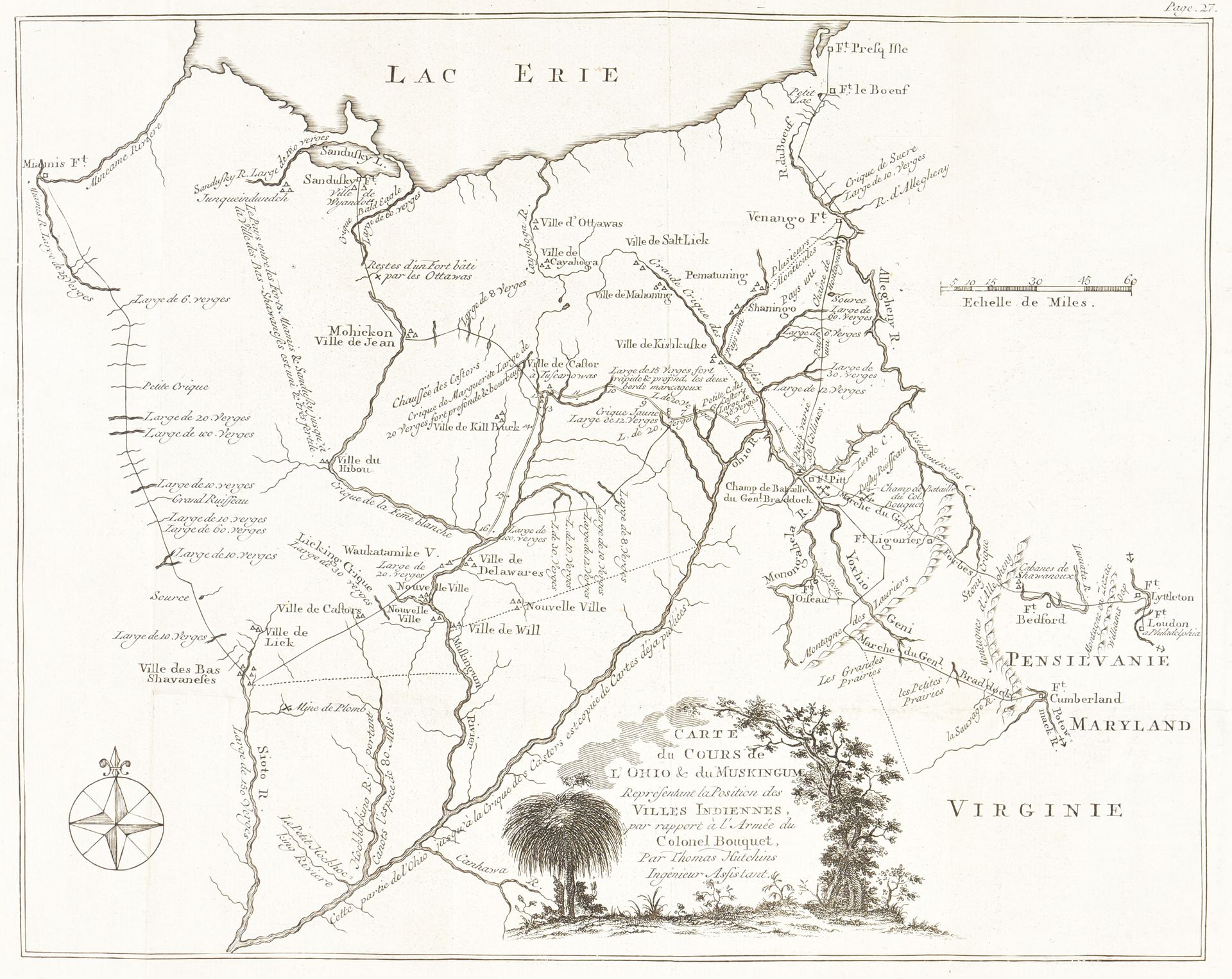
5 interesting maps. 1. map from the North-West Küste von Amerika mit dem Laufe des King George u. der Queen Charlotte in den Jahren 1786 & 1787. Engr. 31,5 x 46,5 cm (sm. tear). From W. Beresford's "Der Kapitaine Portlock's und Dixon's Reisen" (Berlin, s.n., ca. 1791). - 2. neue und verbesserte Carte von der Küste von Labrador. [Leipzig, 1781]. Engr. 25,5 x 35,5 cm, laid paper, 2 watermarks. Rare. - 3 Hutchkins, Th. - Map of the course of the Ohio & Muskingum representing the position of the Indian towns, in relation to the army of Colonel Bouquet. Engr. 25.5 x 31.5 cm. From H. Bouquet's "Relation historique de l'expédition contre les Indiens de l'Ohio" (Amst., M.M. Rey, 1769). - 4 Karte der nordamericanischen Polar-Länder zu Kane's Nordpolfahrten. Leipzig, O. Spamer, 19th c. Lithography, 28.7 x 36 cm. - 5 Huot, V. - United States. From "Atlas Universel" (Paris, Dufrénoy, 1804). Colored lithograph, 44 x 54 cm (central folding split).
512
5 interesting maps. 1. map from the North-West Küste von Amerika mit dem Laufe des King George u. der Queen Charlotte in den Jahren 1786 & 1787. Engr. 31,5 x 46,5 cm (sm. tear). From W. Beresford's "Der Kapitaine Portlock's und Dixon's Reisen" (Berlin, s.n., ca. 1791). - 2. neue und verbesserte Carte von der Küste von Labrador. [Leipzig, 1781]. Engr. 25,5 x 35,5 cm, laid paper, 2 watermarks. Rare. - 3 Hutchkins, Th. - Map of the course of the Ohio & Muskingum representing the position of the Indian towns, in relation to the army of Colonel Bouquet. Engr. 25.5 x 31.5 cm. From H. Bouquet's "Relation historique de l'expédition contre les Indiens de l'Ohio" (Amst., M.M. Rey, 1769). - 4 Karte der nordamericanischen Polar-Länder zu Kane's Nordpolfahrten. Leipzig, O. Spamer, 19th c. Lithography, 28.7 x 36 cm. - 5 Huot, V. - United States. From "Atlas Universel" (Paris, Dufrénoy, 1804). Colored lithograph, 44 x 54 cm (central folding split).