Description
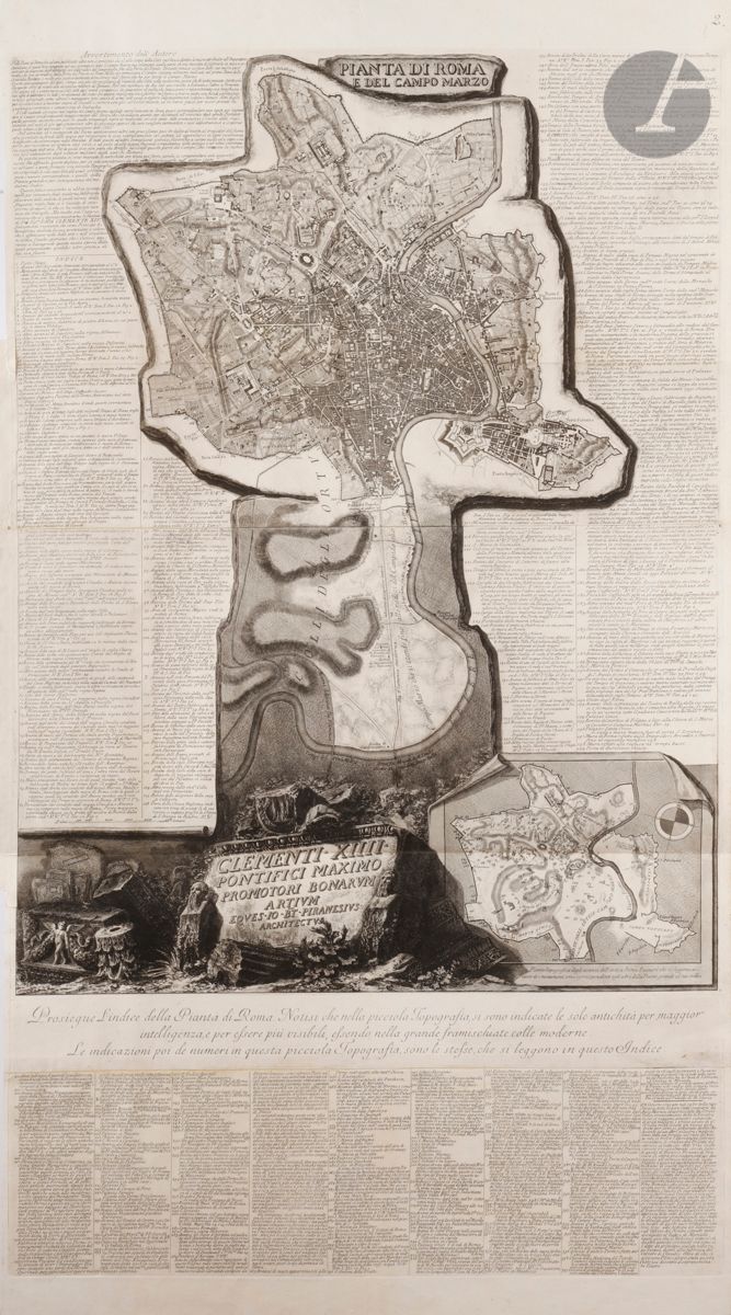
Giambattista Piranesi (1720-1778) Pianta de Roma e del Campo Marzo. 1774. Etching and burin. [730 x 1320]. Focillon 600; Wilton-Ely 1097.1008. Very fine proof in three folded pieces, filled in three for inclusion in an album. Number 3 in pen and sepia ink in the upper right corner. Small brownish spots at the extreme left edge. Traces of folds and old reinforcement bands in places at the edges of the folio on the verso. Good margins. 1st Parisian edition. The main map has the particularity to be designed with the south placed at the top. It renders in trompe l'oeil the effect of being engraved in stone, in the manner used by Piranesi in his Antichità Romane, in homage to the ancient Forma Urbis Romanae, a huge map engraved in marble under Septimius Severus (193-211 BC). The main map shows the Aurelian Wall surrounding 18th century Rome, whose territory extends northwards towards the Porta del Popolo and Campo Marzio. At the bottom right is a smaller map showing the main ancient monuments and places in Rome. The artist had a complete index of the 402 sites and buildings engraved, which are those that also appear in his publications such as Antichità Romane, Della Magnificenza and Campo Marzio.
69
Giambattista Piranesi (1720-1778) Pianta de Roma e del Campo Marzo. 1774. Etching and burin. [730 x 1320]. Focillon 600; Wilton-Ely 1097.1008. Very fine proof in three folded pieces, filled in three for inclusion in an album. Number 3 in pen and sepia ink in the upper right corner. Small brownish spots at the extreme left edge. Traces of folds and old reinforcement bands in places at the edges of the folio on the verso. Good margins. 1st Parisian edition. The main map has the particularity to be designed with the south placed at the top. It renders in trompe l'oeil the effect of being engraved in stone, in the manner used by Piranesi in his Antichità Romane, in homage to the ancient Forma Urbis Romanae, a huge map engraved in marble under Septimius Severus (193-211 BC). The main map shows the Aurelian Wall surrounding 18th century Rome, whose territory extends northwards towards the Porta del Popolo and Campo Marzio. At the bottom right is a smaller map showing the main ancient monuments and places in Rome. The artist had a complete index of the 402 sites and buildings engraved, which are those that also appear in his publications such as Antichità Romane, Della Magnificenza and Campo Marzio.
