Vaugondy,R.De.
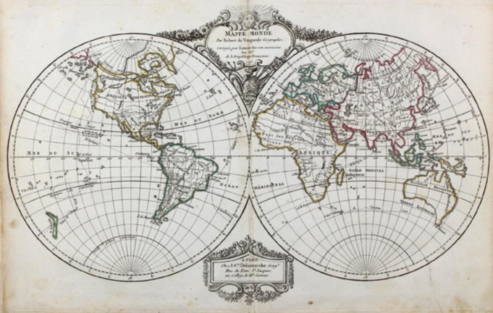
Nouvel Atlas portatif destiné principalement pour l'instruction de la jeunesse, d'après La Géographie moderne de feu l'Abbé Delacroix. With gest. Title, 7 pp. gest. Text and 53 double-page border-colored copper maps and an additional folding map. Paris, Lamarche, 1795. 4°. 8 p. gest. Text. Half-leather binding (bumped, joints chipped and unattractively fixed with transparent tape). In different variants published hand atlas, present with the 4 world maps, 4 continents (Europe, Asia, Africa and America) and individual maps of Europe (28), Asia (4), Africa (2), America (4) and the ancient world (7). Additionally bound in a large folding map of the French Republic, dated 1799. - Some finger spotting, a few maps with mostly backed marginal tears, in the last third larger dampstains in the margins, partly reaching into the illustration. The folding map backed in the folds. - Handwritten ownership notes on endpapers and title. - With engraved title, 7 pages engraved text and 53 copper maps as well as 1 additional folding map. Contemporary half leather (damaged). Somewhat stained, few maps with tears (most repaired), ending with waterstain.