Description
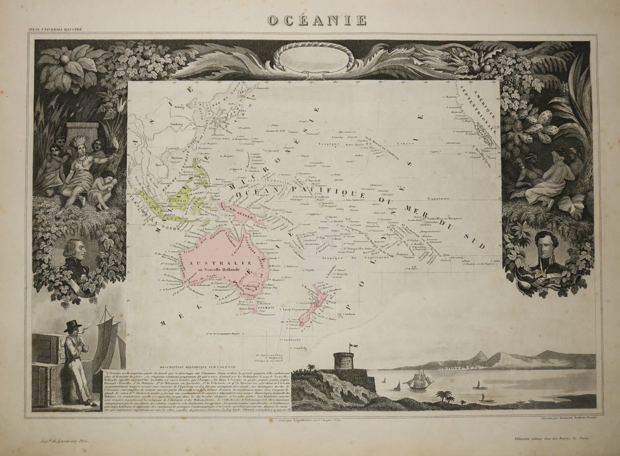
OCEANIA - MAP OF "THE OCEANIA", by Victor LEVASSEUR (Atlas National de la France illustrée), 1852. Map engraved by Laguillermie. Antique colours. Printed by Lemercier and published by Pelissier, in Paris. Margins. Nice map illustrated by Raimond Bonheur. 36,5 x 52 cm. Condition A (some rare small foxing).
18
OCEANIA - MAP OF "THE OCEANIA", by Victor LEVASSEUR (Atlas National de la France illustrée), 1852. Map engraved by Laguillermie. Antique colours. Printed by Lemercier and published by Pelissier, in Paris. Margins. Nice map illustrated by Raimond Bonheur. 36,5 x 52 cm. Condition A (some rare small foxing).