Description
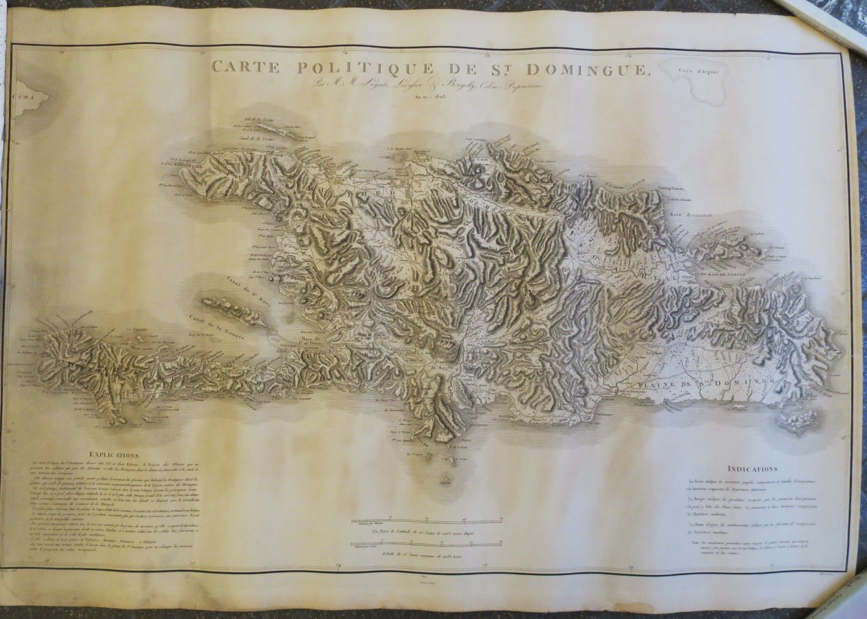
HAITI - DOMINICAN REPUBLIC - "Political map of ST DOMINGUE, year xi - 1803 / by M.M. Leyritz, Levassor & Bourjolly". Large engraved map. Designed by Viller and printed by Jean-Baptiste Croisey. Margins. 74 x 107,5 cm. Condition B (some light foxing and/or traces of sunning, rare short marginal tears, rolled).
17
HAITI - DOMINICAN REPUBLIC - "Political map of ST DOMINGUE, year xi - 1803 / by M.M. Leyritz, Levassor & Bourjolly". Large engraved map. Designed by Viller and printed by Jean-Baptiste Croisey. Margins. 74 x 107,5 cm. Condition B (some light foxing and/or traces of sunning, rare short marginal tears, rolled).