Description
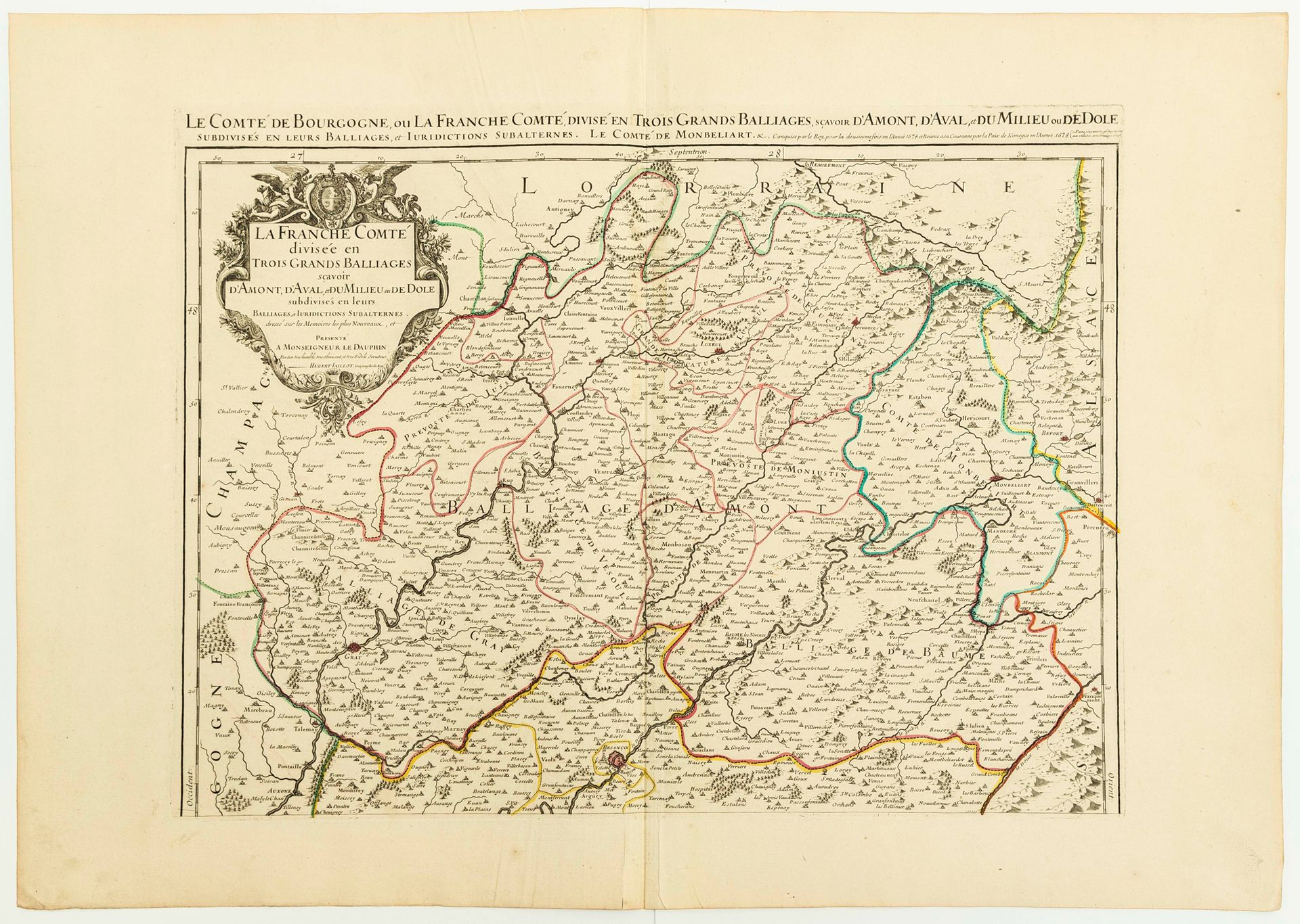
MAP of 1693: "The County of BOURGOGNE or LA FRANCHE COMTÉ, divided into three large bailliages namely of AMONT, AVAL, and MILIEU or DOLE, subdivided into their Bailliages and subaltern Jurisdictions. The County of Montbéliard.., united to the Crown in 1678." By Hubert JAILLOT, Geographer of the King, in Paris, 1693. (Gray, Marnay, Besançon, Monboson, Vesoul, Jussey, Luxeuil, Lure, Grandmont, Baume, Montbéliard, Faucogney...) (54 x 76 cm) Condition. A
98
MAP of 1693: "The County of BOURGOGNE or LA FRANCHE COMTÉ, divided into three large bailliages namely of AMONT, AVAL, and MILIEU or DOLE, subdivided into their Bailliages and subaltern Jurisdictions. The County of Montbéliard.., united to the Crown in 1678." By Hubert JAILLOT, Geographer of the King, in Paris, 1693. (Gray, Marnay, Besançon, Monboson, Vesoul, Jussey, Luxeuil, Lure, Grandmont, Baume, Montbéliard, Faucogney...) (54 x 76 cm) Condition. A