De Hooghe, Romeyn
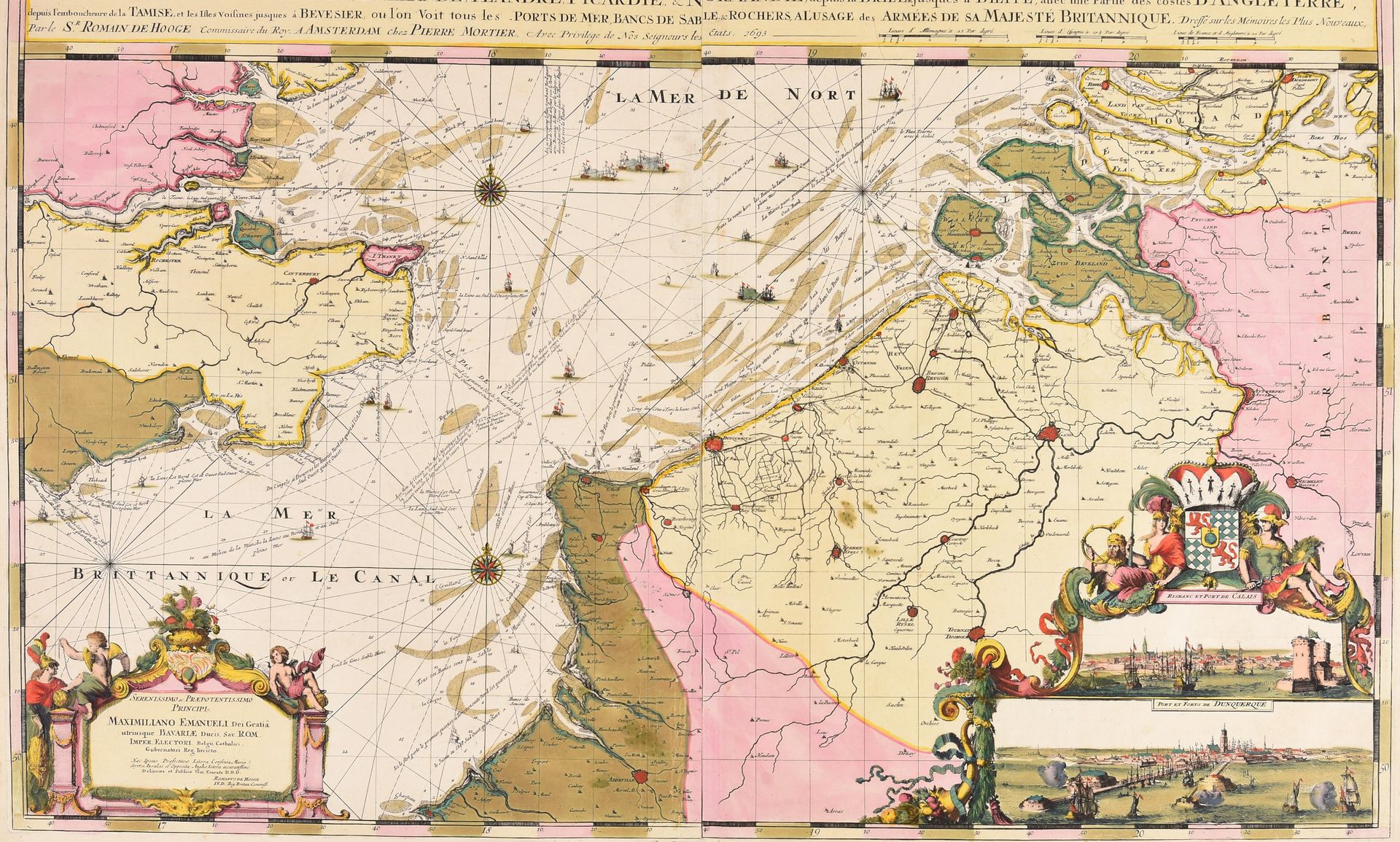
DE HOOGHE, Romain Carte nouvelle des costes de Hollande, Zéelande, Flandre, Picardie, & Normandie, depuis la Brille jusques à Dieppe, avec une partie des costes d'Angleterre [...] à l'usage des armées de sa Majesté Britannique. Amsterdam P. Mortier 1693 Engr, 59,5 x 94,5 cm, assembled from 2 plates, old hand-coloured (marg. damp stain). Nautical chart of British origin designed andched by Romeyn de Hooghe who was at that time in the service of King William III of England. With 2 inset views of Calais and Dunkirk. From Pierre Mortier's "Cartes marines à l'usage du Roy de la Grande Bretagne" that was the most expensive sea-atlas published in 17th-c. Amsterdam. Contrary to Mortier's counterfeited "Neptune François", published jointly with H. Jaillot, this work was not based on a printed French prototype, but on ms. charts. The magnificent work was intended as a showpiece rather than as something being used by pilots at sea. Ref. Koeman IV, M. Mor 5/1.