Description
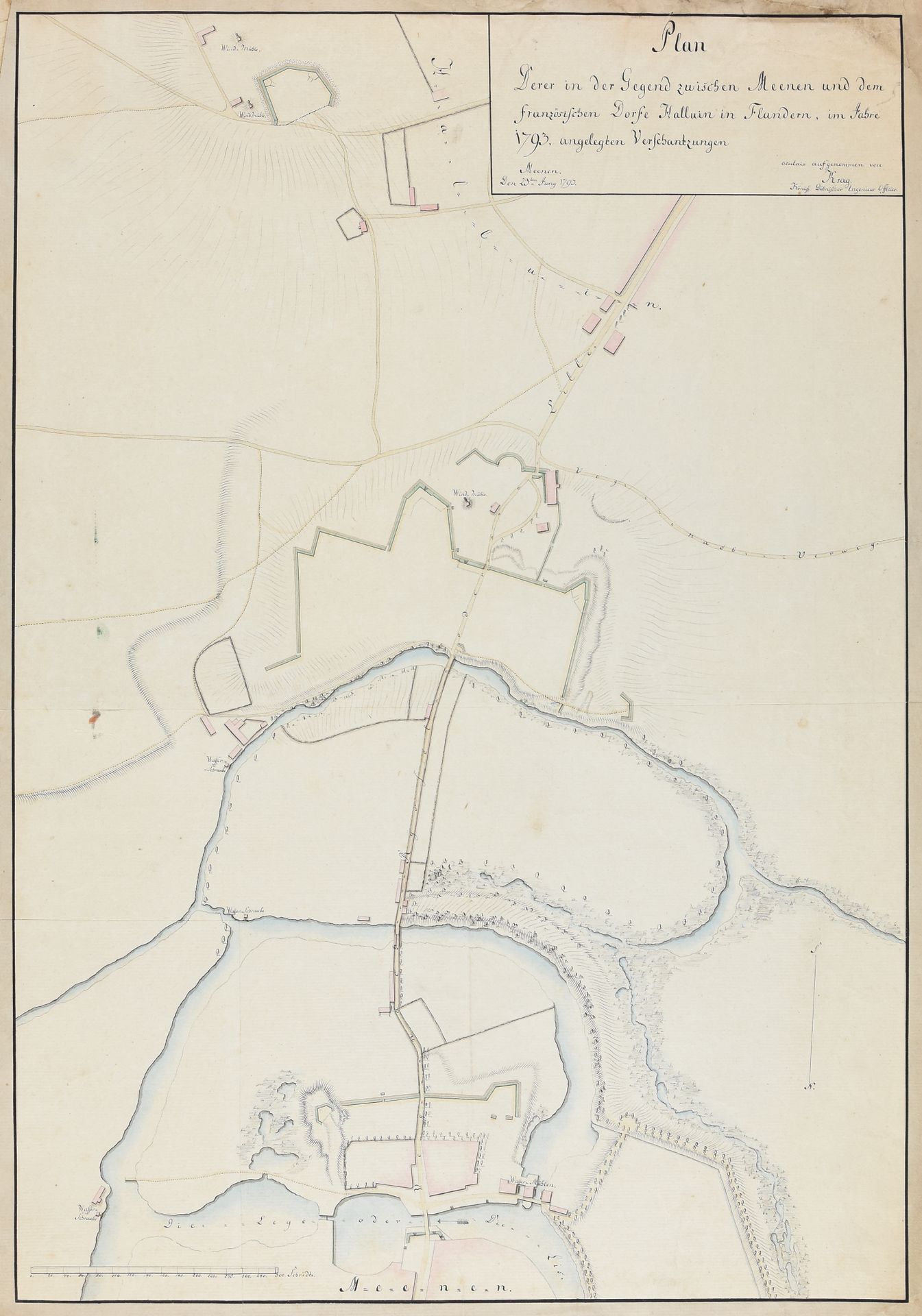
KRAG, Rasmus "Plan derer in der Gegend zwischen Meenen und dem französischen Dorfe Halluin in Flandern, im Jahre 1793, angelegten Verschantzungen." 1793 Drawing, 46 x 67 cm, pen, black ink and watercolour, on laid paper (upper corner a bit soiled). Plan of the entrenchments between Menin and Halluin by Rasmus Krag (1763-1838), a military officer and engineer in the service of Denmark-Norway. Krag served for a short time with the Austrian troops under the Prince of Coburg at the Siege of Valenciennes (13 June to 28 July 1793). This map shows how a part of Coburg's army was reconnoitring the area while the rest of his army was besieging Valenciennes. Ref. Dansk Biografisk Leksikon 9, pp. 444-446.
530
KRAG, Rasmus "Plan derer in der Gegend zwischen Meenen und dem französischen Dorfe Halluin in Flandern, im Jahre 1793, angelegten Verschantzungen." 1793 Drawing, 46 x 67 cm, pen, black ink and watercolour, on laid paper (upper corner a bit soiled). Plan of the entrenchments between Menin and Halluin by Rasmus Krag (1763-1838), a military officer and engineer in the service of Denmark-Norway. Krag served for a short time with the Austrian troops under the Prince of Coburg at the Siege of Valenciennes (13 June to 28 July 1793). This map shows how a part of Coburg's army was reconnoitring the area while the rest of his army was besieging Valenciennes. Ref. Dansk Biografisk Leksikon 9, pp. 444-446.