Description
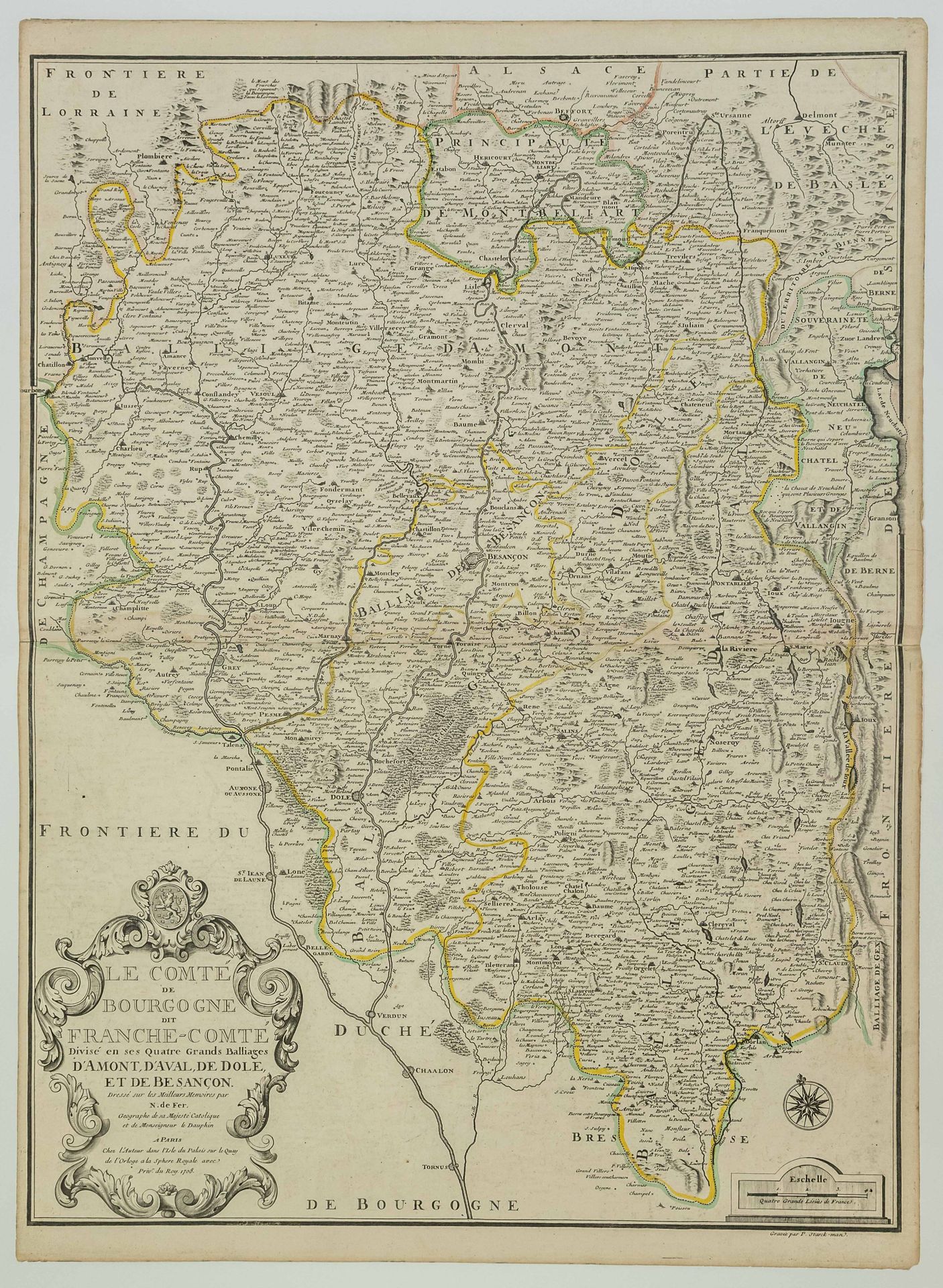
Map of 1708 : " The County of BOURGOGNE called FRANCHE COMTÉ, divided in its four big Bailiwicks of AMONT, AVAL, DE DÔLE, and BESANÇON. Drawn up on the best memoirs by Nicolas de FER, geographer of his Catholic Majesty and of Monseigneur le Dauphin. In Paris, at the author's in the Isle du Palais on the Quai de l'horloge, "À la Sphère Royale," with privilege of the King, 1708." (Besançon (25, center), Vesoul (70), St Claude (39), Arbois (39), Poligny (39), Pontarlier (25), Lure (70), Luxeuil (70), Vesoul (70),...) Map (71 x 51.5 cm) Condition A
74
Map of 1708 : " The County of BOURGOGNE called FRANCHE COMTÉ, divided in its four big Bailiwicks of AMONT, AVAL, DE DÔLE, and BESANÇON. Drawn up on the best memoirs by Nicolas de FER, geographer of his Catholic Majesty and of Monseigneur le Dauphin. In Paris, at the author's in the Isle du Palais on the Quai de l'horloge, "À la Sphère Royale," with privilege of the King, 1708." (Besançon (25, center), Vesoul (70), St Claude (39), Arbois (39), Poligny (39), Pontarlier (25), Lure (70), Luxeuil (70), Vesoul (70),...) Map (71 x 51.5 cm) Condition A