Description
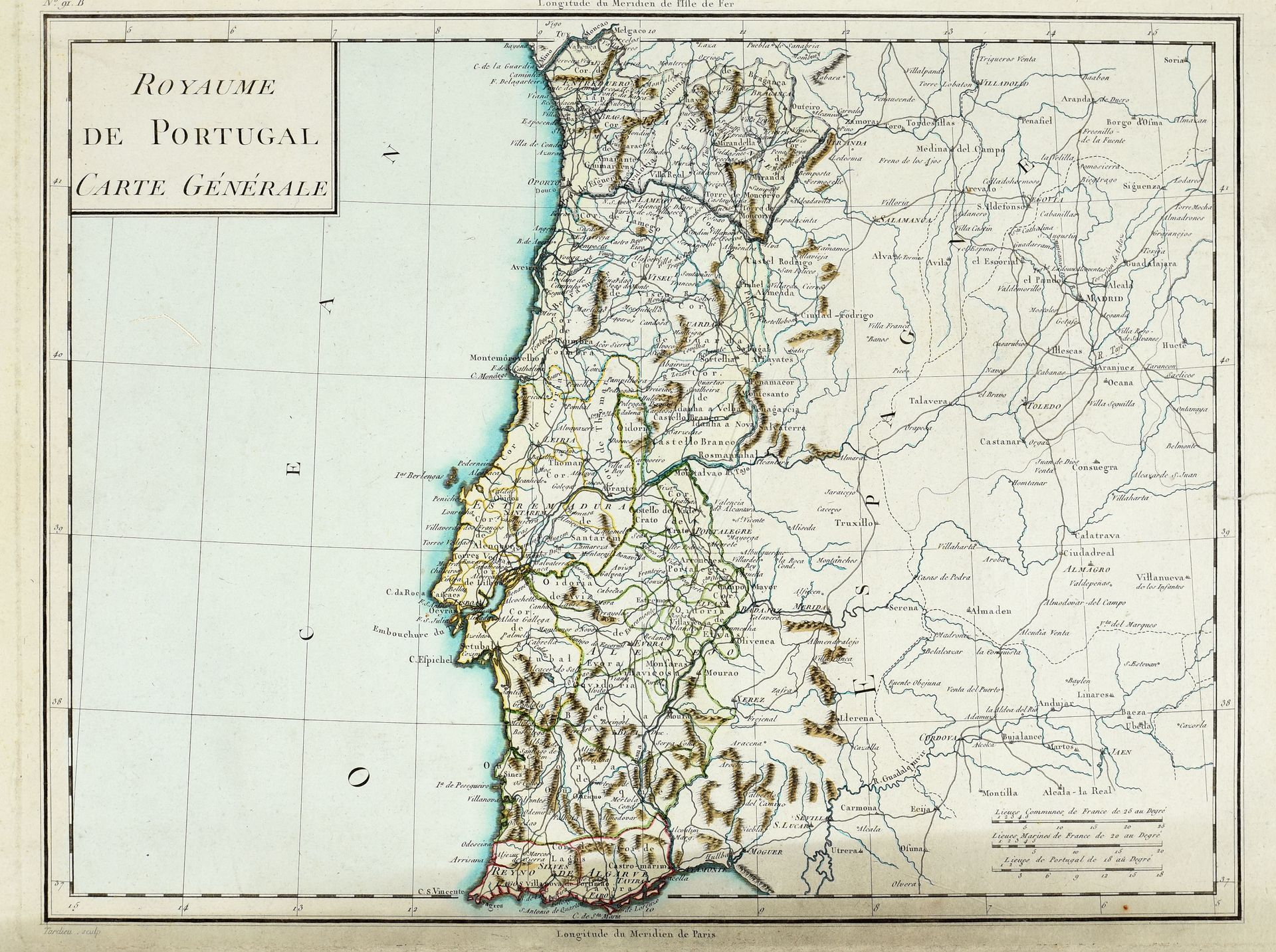
18 maps. 1. Lopez, Tomas. - Mapa geográfico de una parte de la provincia de Burgos [...]. Madrid, [T. Lopez], 1784. Engr., 80 x 84 cm, borders hand-coloured (foldings part. split, some stains). Mounted on cloth. - 2. Id. - Mapa que comprehende el partido del Baston de Laredo, y quatro villas de la costa [...]. Madrid, [T. Lopez], 1774. Engr., 77 x 74 cm. Mounted on cloth. Both maps were included in Lopez' Atlas Geográfico de España. Ref. Bizkaia regional library. - 3-18. 15 maps of Portugal and Spain, incl. "Espagne et Portugal, carte détaillée en IX feuilles. Gravé par P.F. Tardieu", 2 general maps, a geographical map, 2 town plans of Lisbon and Madrid, a historical map "Hispanie Betique et Lusitanie". Engr., 35 x 46 cm, printed on blue paper and hand-coloured (marg. waterstains).
1055
18 maps. 1. Lopez, Tomas. - Mapa geográfico de una parte de la provincia de Burgos [...]. Madrid, [T. Lopez], 1784. Engr., 80 x 84 cm, borders hand-coloured (foldings part. split, some stains). Mounted on cloth. - 2. Id. - Mapa que comprehende el partido del Baston de Laredo, y quatro villas de la costa [...]. Madrid, [T. Lopez], 1774. Engr., 77 x 74 cm. Mounted on cloth. Both maps were included in Lopez' Atlas Geográfico de España. Ref. Bizkaia regional library. - 3-18. 15 maps of Portugal and Spain, incl. "Espagne et Portugal, carte détaillée en IX feuilles. Gravé par P.F. Tardieu", 2 general maps, a geographical map, 2 town plans of Lisbon and Madrid, a historical map "Hispanie Betique et Lusitanie". Engr., 35 x 46 cm, printed on blue paper and hand-coloured (marg. waterstains).
You may also like