Description
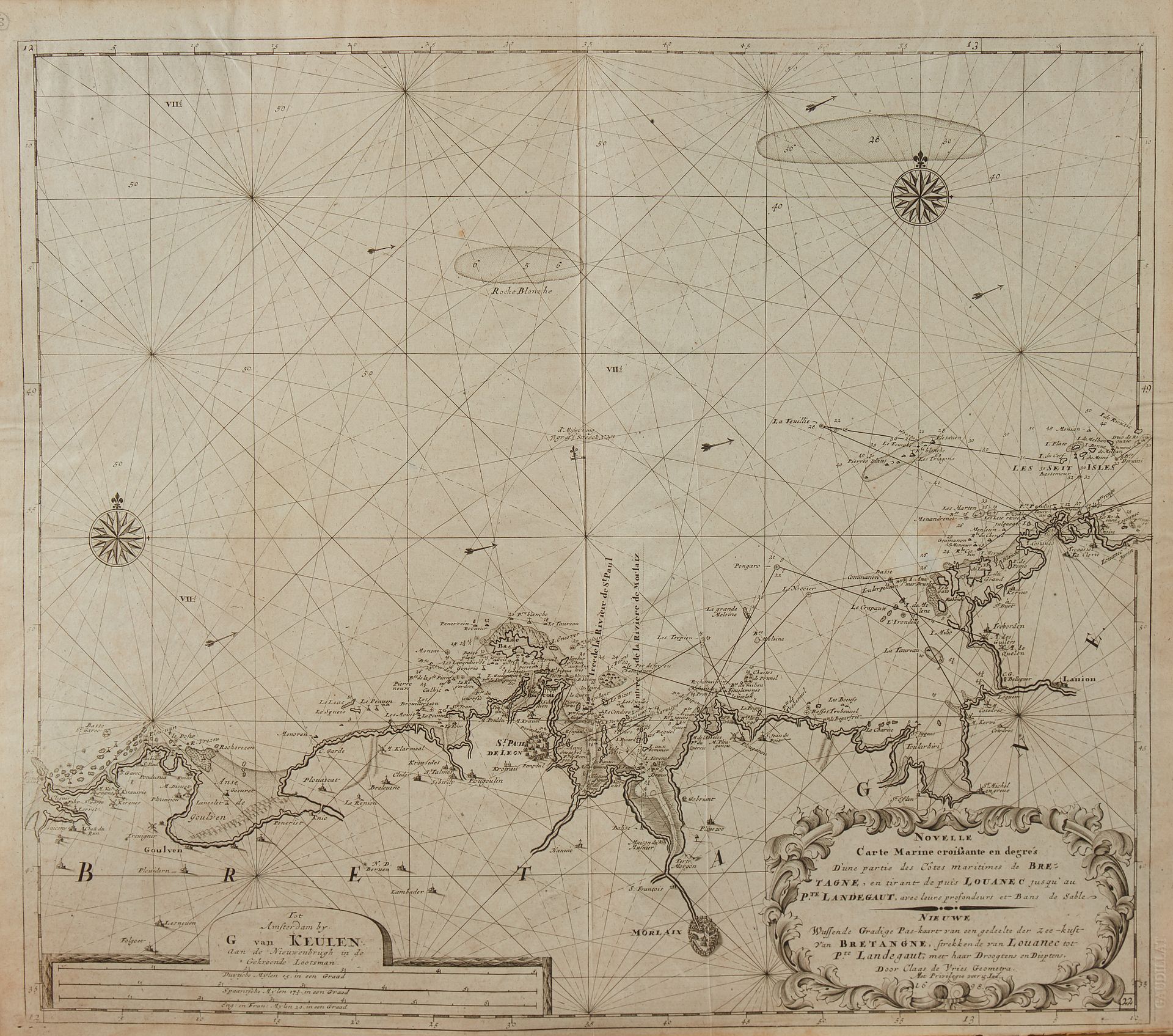
VAN KEULEN, G. Nouvelle carte marine...des côtes maritimes de Bretagne en tirant depuis Louanec jusqu'au P.te Landegaut. Amsterdam, 1698. Black and white. Copy on fine paper slightly yellowed. Attached a copy in poor condition. 516 x 594 mm. Map by Claas de Vries published in the "Zee Atlas" in 1698. Map N°22. Title in Dutch and French. Two wind roses, currents indicated by arrows. Copy reproduced in C. Gaudillat, Anciennes Cartes Marines de la Bretagne 1580-1800, Pl. N°47.
93
VAN KEULEN, G. Nouvelle carte marine...des côtes maritimes de Bretagne en tirant depuis Louanec jusqu'au P.te Landegaut. Amsterdam, 1698. Black and white. Copy on fine paper slightly yellowed. Attached a copy in poor condition. 516 x 594 mm. Map by Claas de Vries published in the "Zee Atlas" in 1698. Map N°22. Title in Dutch and French. Two wind roses, currents indicated by arrows. Copy reproduced in C. Gaudillat, Anciennes Cartes Marines de la Bretagne 1580-1800, Pl. N°47.