Description
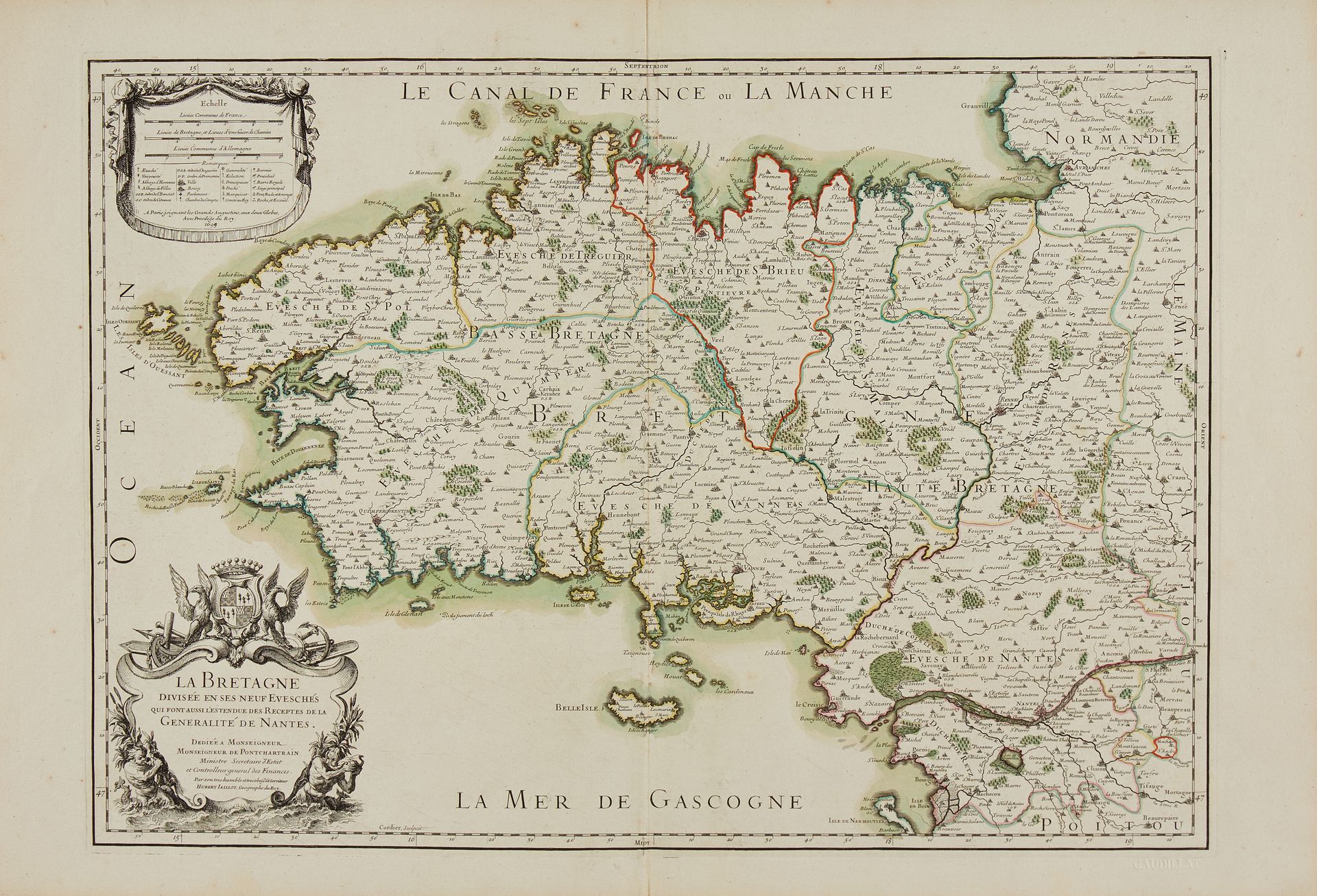
SANSON / JAILLOT. La Bretagne divisée en ses neuf évèchés. Amsterdam, [1696]. Col. of the time. Map in 2 assembled sheets. Oxidation of the green colour with loss of paper below Pontivy. 534 x 790 mm. Second state published in the Dutch forgery of Jaillot's atlas "Atlas nouveau... "The author of this map remains to be identified, is it Guillaume Sanson or Pierre Moullart-Sanson? § Copy reproduced in C.Gaudillat, Cartes anciennes de la Bretagne 1582-1800, Pl. N°26. Joint: JAILLOT, A.H. Second state of this map of Brittany published in the "Atlas Français", with the reinstatement of the Houat and "Heydic" (Hoedic) Islands. The map of 1690 is the first map to use the denomination "Le Canal de France ou La Manche".
90
SANSON / JAILLOT. La Bretagne divisée en ses neuf évèchés. Amsterdam, [1696]. Col. of the time. Map in 2 assembled sheets. Oxidation of the green colour with loss of paper below Pontivy. 534 x 790 mm. Second state published in the Dutch forgery of Jaillot's atlas "Atlas nouveau... "The author of this map remains to be identified, is it Guillaume Sanson or Pierre Moullart-Sanson? § Copy reproduced in C.Gaudillat, Cartes anciennes de la Bretagne 1582-1800, Pl. N°26. Joint: JAILLOT, A.H. Second state of this map of Brittany published in the "Atlas Français", with the reinstatement of the Houat and "Heydic" (Hoedic) Islands. The map of 1690 is the first map to use the denomination "Le Canal de France ou La Manche".