Description
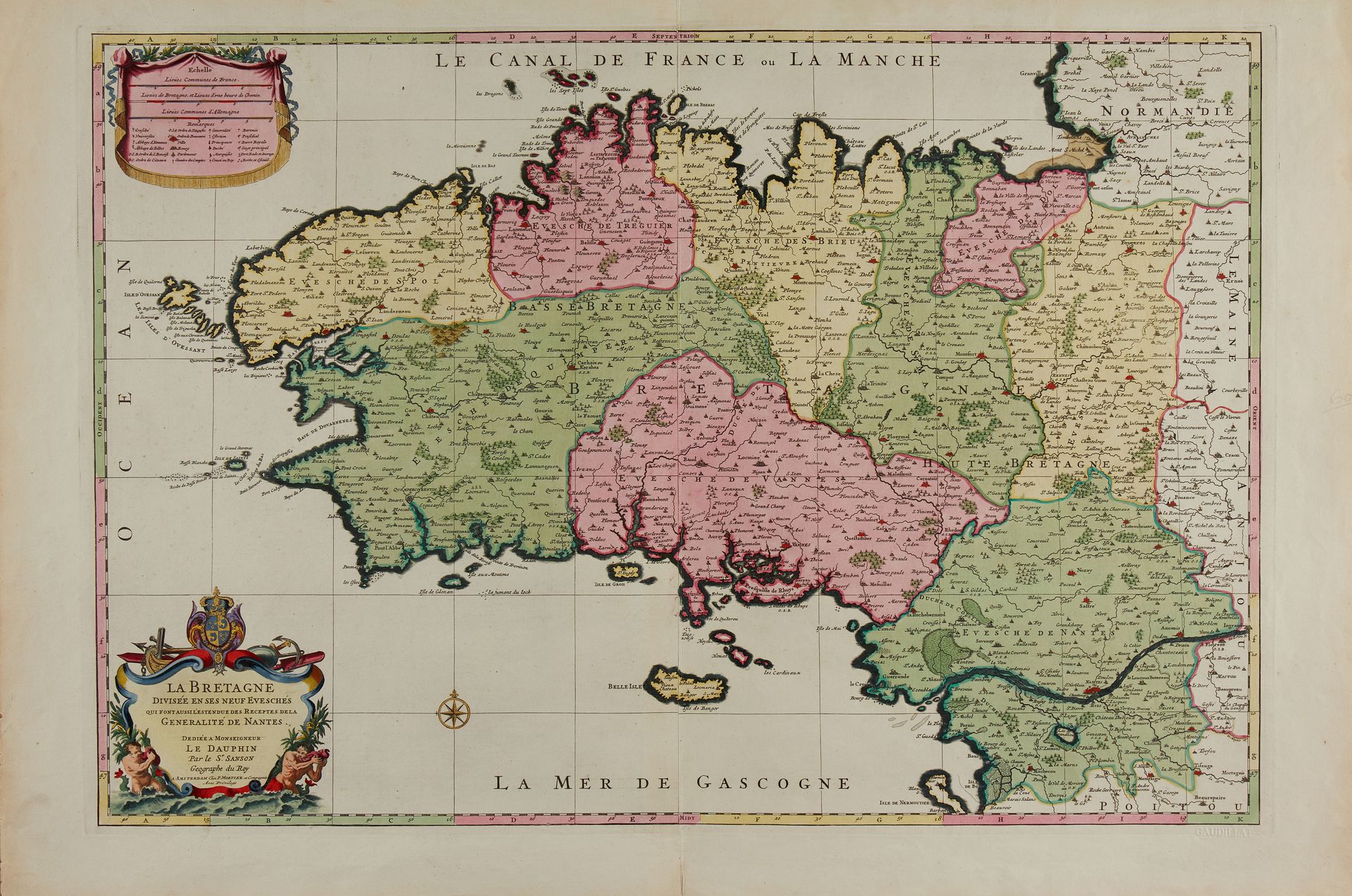
SANSON / JAILLOT / MORTIER. La Bretagne divisée en ses neuf évèchés. Amsterdam, [1696]. Very beautiful full colour contemporary copy. Magnificent copy on strong paper in a splendid period colouring with gold highlights. Map in 2 assembled sheets + a separate plate of "Alphabetical table of the names of cities... which are on the map of Brittany", also in period colours. 534 x 790 mm. Spectacular map of Brittany originally published in the Dutch forgery of Jaillot's atlas "Atlas nouveau...". This is the third state published in Amsterdam by Pierre Mortier et compagnie. The copy is in splendid period colours with gold highlights and is accompanied by its alphabetical table, also in period colours. The author of this map remains to be identified, is it Guillaume Sanson or Pierre Moullart-Sanson? Mortier's map has many differences: it is of a larger format; longitudes and latitudes have appeared; the cartouche has been modified: the eagles have disappeared; the cartouche of the scales no longer includes an address, a privilege or a date; a compass rose is located south of the Glénan Islands; the entire map is squared. § Copy reproduced in C. Gaudillat, Cartes anciennes de la Bretagne 1582-1800, pl. N°26.
89
SANSON / JAILLOT / MORTIER. La Bretagne divisée en ses neuf évèchés. Amsterdam, [1696]. Very beautiful full colour contemporary copy. Magnificent copy on strong paper in a splendid period colouring with gold highlights. Map in 2 assembled sheets + a separate plate of "Alphabetical table of the names of cities... which are on the map of Brittany", also in period colours. 534 x 790 mm. Spectacular map of Brittany originally published in the Dutch forgery of Jaillot's atlas "Atlas nouveau...". This is the third state published in Amsterdam by Pierre Mortier et compagnie. The copy is in splendid period colours with gold highlights and is accompanied by its alphabetical table, also in period colours. The author of this map remains to be identified, is it Guillaume Sanson or Pierre Moullart-Sanson? Mortier's map has many differences: it is of a larger format; longitudes and latitudes have appeared; the cartouche has been modified: the eagles have disappeared; the cartouche of the scales no longer includes an address, a privilege or a date; a compass rose is located south of the Glénan Islands; the entire map is squared. § Copy reproduced in C. Gaudillat, Cartes anciennes de la Bretagne 1582-1800, pl. N°26.