Description
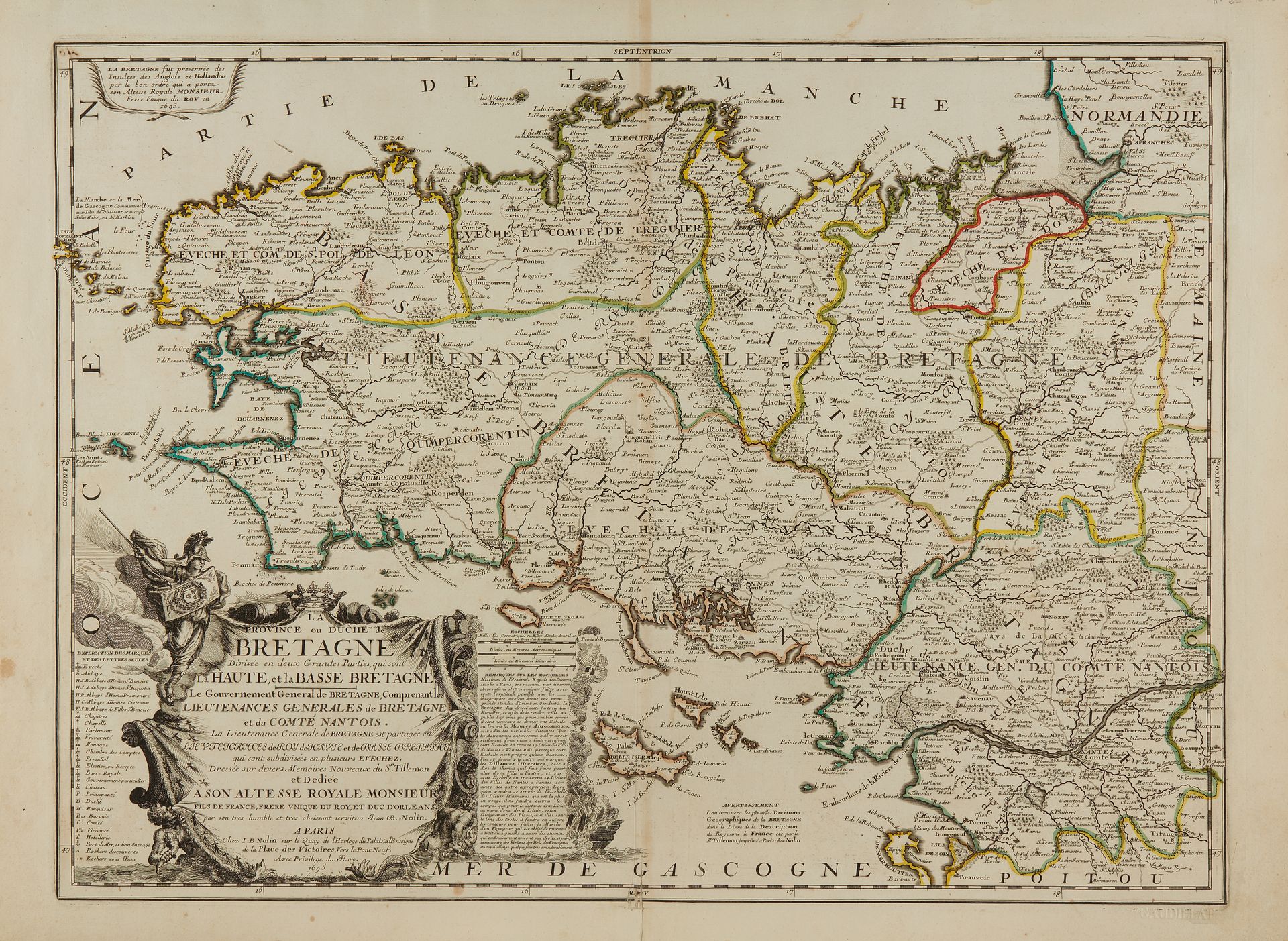
NOLIN, J.-B. La Province ou Duché de Bretagne. Paris, 1695. Boundaries in old col. Nice copy. Small restoration at the bottom of the central fold to the fillet. 450 x 600 mm. First state at the date of 1695. This map is actually the result of the work of Sieur de Tillemon, pseudonym of Jean Nicolas de Tralage. The map is divided into Upper and Lower Brittany and indicates the general lieutenancies of Brittany and the County of Nantois. Decorated with a large decorative title cartouche. § Copy reproduced in C. Gaudillat, Cartes anciennes de la Bretagne 1582-1800, pl. N°29.
84
NOLIN, J.-B. La Province ou Duché de Bretagne. Paris, 1695. Boundaries in old col. Nice copy. Small restoration at the bottom of the central fold to the fillet. 450 x 600 mm. First state at the date of 1695. This map is actually the result of the work of Sieur de Tillemon, pseudonym of Jean Nicolas de Tralage. The map is divided into Upper and Lower Brittany and indicates the general lieutenancies of Brittany and the County of Nantois. Decorated with a large decorative title cartouche. § Copy reproduced in C. Gaudillat, Cartes anciennes de la Bretagne 1582-1800, pl. N°29.