Description
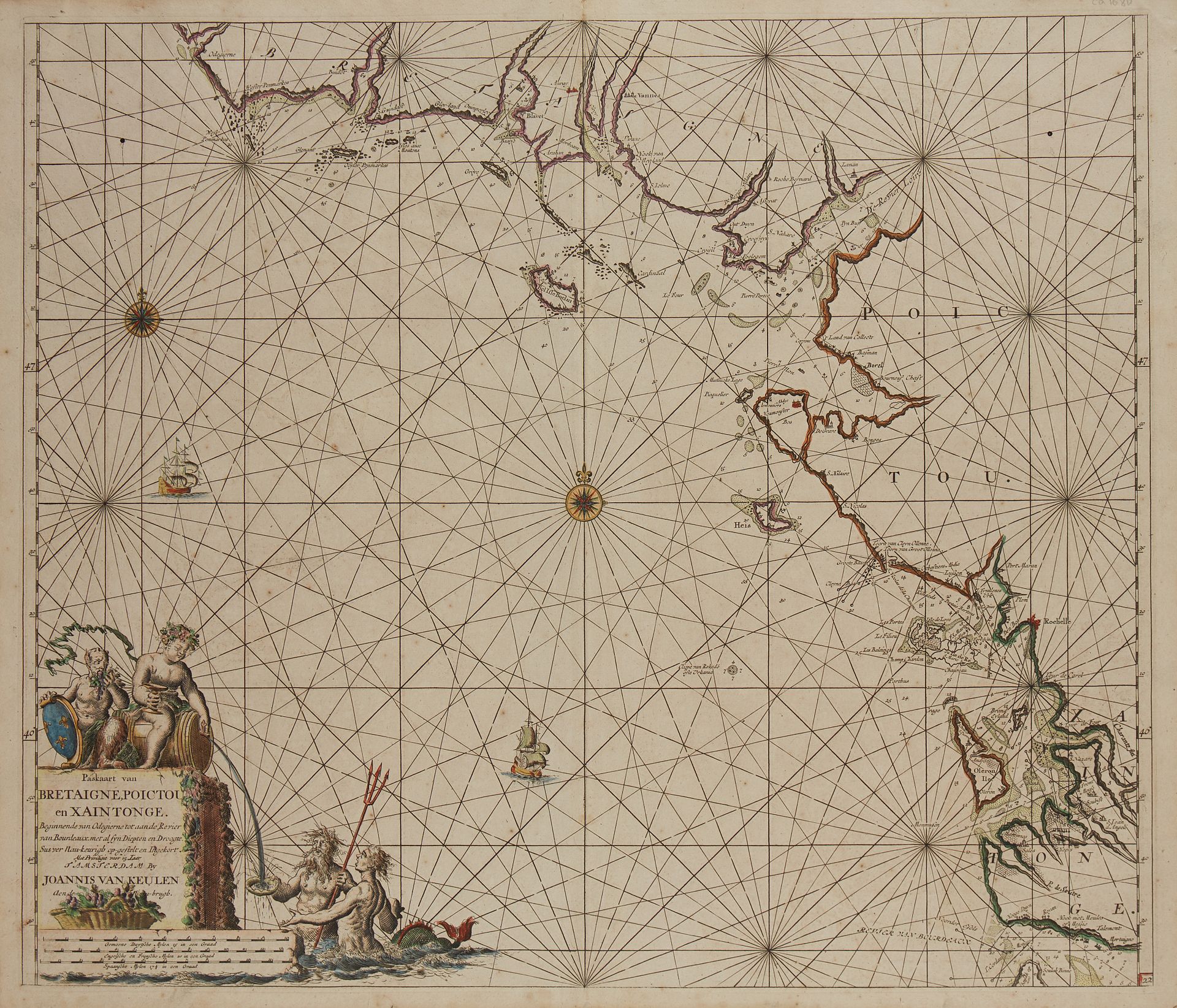
VAN KEULEN, J. Paaskaart van Bretaigne, Poictou en Xaintonge. Amsterdam, ca. 1680. Col. Minor foxing, paper slightly yellowed. 503 x 587 mm. Map showing the coast from Hodierne to the Gironde from the atlas of Johannes Van Keulen. Map N°22. Two wind roses and two boats. Nice title cartouche. Blavet but not yet Port-Louis nor, of course, Lorient. § Copy reproduced in Anciennes Cartes Marines de la Bretagne 1580-1800, Pl. N°18.
67
VAN KEULEN, J. Paaskaart van Bretaigne, Poictou en Xaintonge. Amsterdam, ca. 1680. Col. Minor foxing, paper slightly yellowed. 503 x 587 mm. Map showing the coast from Hodierne to the Gironde from the atlas of Johannes Van Keulen. Map N°22. Two wind roses and two boats. Nice title cartouche. Blavet but not yet Port-Louis nor, of course, Lorient. § Copy reproduced in Anciennes Cartes Marines de la Bretagne 1580-1800, Pl. N°18.