Description
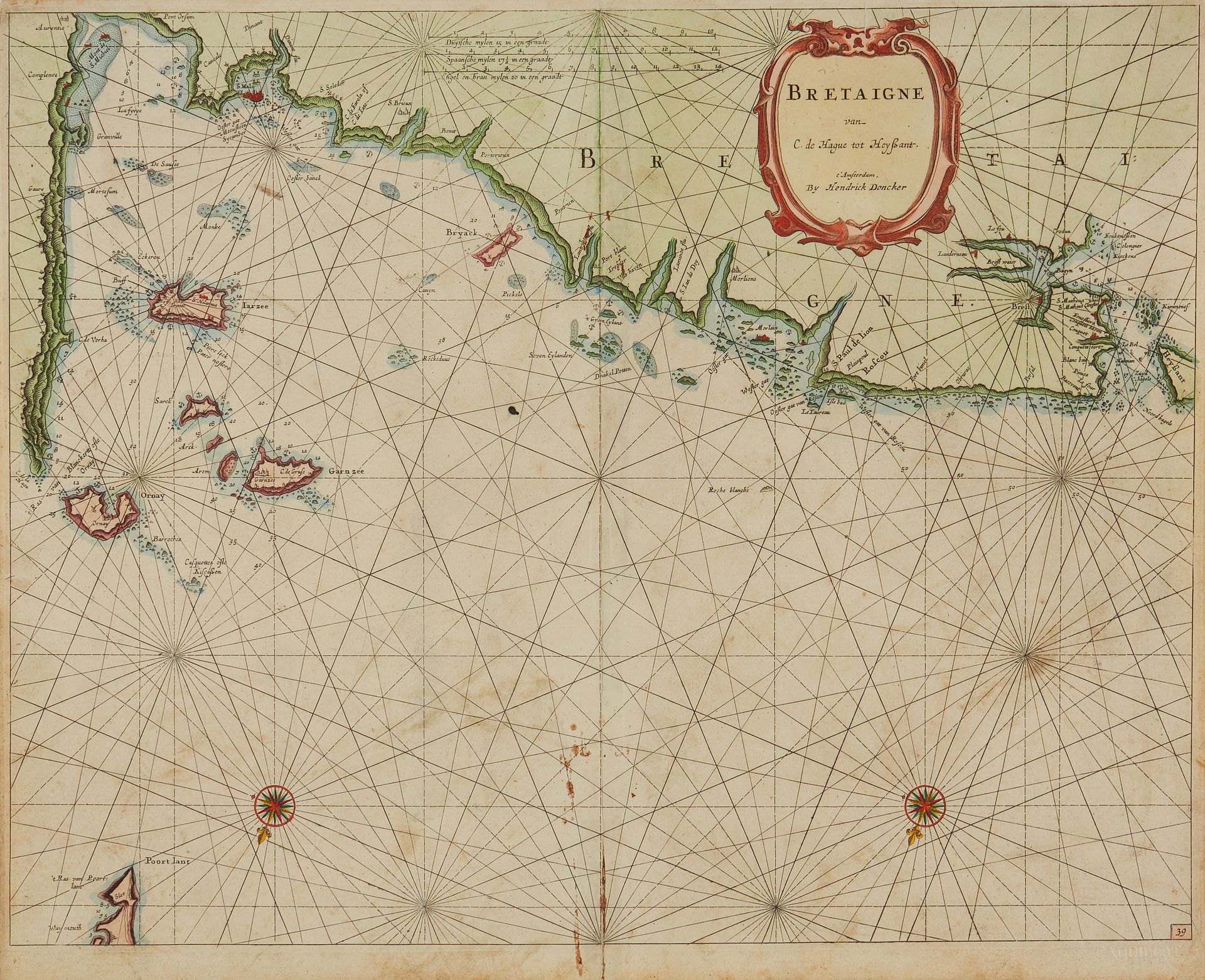
DONCKER, H. Bretaigne van C. de Hague tot Heyssant. Amsterdam, 1676. Col. Browned paper, small brown spots at bottom of centrefold (tiny hole). 428 x 525 mm. Paginated marine map 39 showing the coast of Brittany with the Channel Islands, Saint-Malo, St-Pol-de-Léon, Brest and the island of Ouessant. Title cartouche and 2 wind roses. Copy reproduced in C. Gaudillat, Anciennes Cartes Marines de la Bretagne 1580-1800, Pl. N°13.
64
DONCKER, H. Bretaigne van C. de Hague tot Heyssant. Amsterdam, 1676. Col. Browned paper, small brown spots at bottom of centrefold (tiny hole). 428 x 525 mm. Paginated marine map 39 showing the coast of Brittany with the Channel Islands, Saint-Malo, St-Pol-de-Léon, Brest and the island of Ouessant. Title cartouche and 2 wind roses. Copy reproduced in C. Gaudillat, Anciennes Cartes Marines de la Bretagne 1580-1800, Pl. N°13.