Description
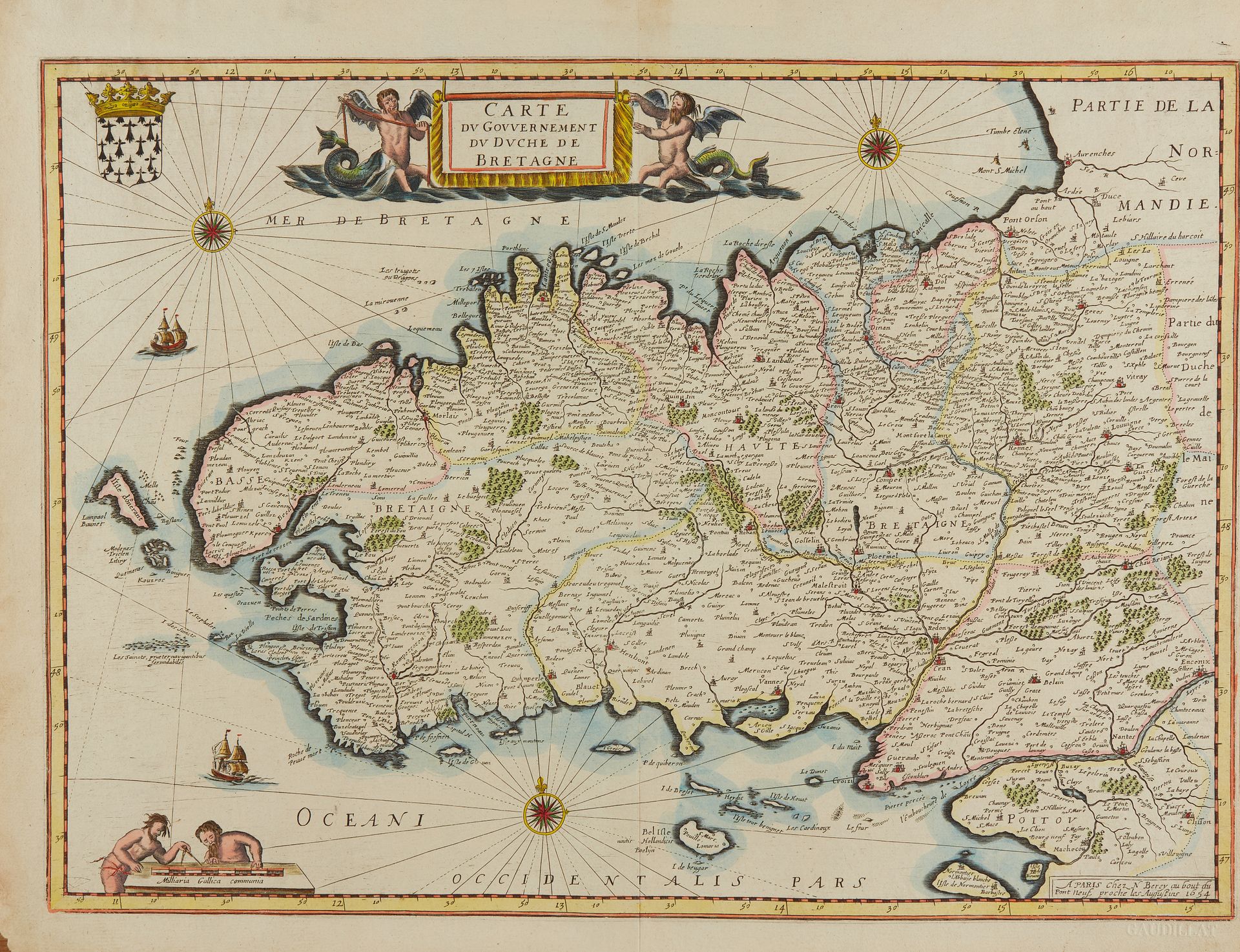
BEREY, N. Carte du Gouvernement du Duché de Bretagne. Paris, 1654. Col. Good copy. 363 x 506 mm. First state of this map copied from Blaeu with modifications. "Mer de Bretagne" has replaced "Mare Britannicum"; names have been added especially for the islands. However, the graphics are inferior in quality to Blaeu's map. § Copy reproduced in C. Gaudillat, Cartes anciennes de la Bretagne 1582-1800, Pl. N°15. Berey, a little-known and lesser-known publisher of maps and prints, published folio maps copied from French and Dutch maps of rather poor execution. Conf. Louis Loeb-Larocque, "Ces Hollandaises habillées à Paris" in Liber Amicorum presented to Nico Israel.
55
BEREY, N. Carte du Gouvernement du Duché de Bretagne. Paris, 1654. Col. Good copy. 363 x 506 mm. First state of this map copied from Blaeu with modifications. "Mer de Bretagne" has replaced "Mare Britannicum"; names have been added especially for the islands. However, the graphics are inferior in quality to Blaeu's map. § Copy reproduced in C. Gaudillat, Cartes anciennes de la Bretagne 1582-1800, Pl. N°15. Berey, a little-known and lesser-known publisher of maps and prints, published folio maps copied from French and Dutch maps of rather poor execution. Conf. Louis Loeb-Larocque, "Ces Hollandaises habillées à Paris" in Liber Amicorum presented to Nico Israel.