Description
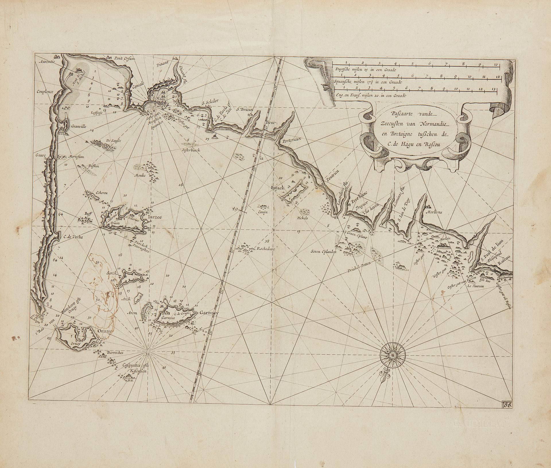
BLAEU, G. Pascaarte vande Zeecusten van Normandie en Bretaigne tuschen de C. de Hagu en Roscou. Amsterdam, 1608-1635. Black and white. Vertical fold along the central fold, paper slightly yellowed. Small pen-and-ink drawing above Ornay. 257 x 357 mm. Very rare nautical chart by William (Jansson) Blaeu published in his maritime atlas "Het Licht der Zee-vaert", 1608 or "Sea Mirror", 1635. North coast of Brittany seen from the sea. From Cape Hague to Roscou (Roscoff). Map No. 66 at bottom right. Title block with scales: Dutch, from 15 to the degree (12.4 cm), Spanish, from 171/2 to the degree (12.7 cm), English and French, from 20 to the degree (12 cm). The degree of latitude 49 is The degree of latitude 49 is inscribed on a line in ais § Copy reproduced in Anciennes Cartes Marines de la Bretagne 1580-1800, Pl. N°5.
46
BLAEU, G. Pascaarte vande Zeecusten van Normandie en Bretaigne tuschen de C. de Hagu en Roscou. Amsterdam, 1608-1635. Black and white. Vertical fold along the central fold, paper slightly yellowed. Small pen-and-ink drawing above Ornay. 257 x 357 mm. Very rare nautical chart by William (Jansson) Blaeu published in his maritime atlas "Het Licht der Zee-vaert", 1608 or "Sea Mirror", 1635. North coast of Brittany seen from the sea. From Cape Hague to Roscou (Roscoff). Map No. 66 at bottom right. Title block with scales: Dutch, from 15 to the degree (12.4 cm), Spanish, from 171/2 to the degree (12.7 cm), English and French, from 20 to the degree (12 cm). The degree of latitude 49 is The degree of latitude 49 is inscribed on a line in ais § Copy reproduced in Anciennes Cartes Marines de la Bretagne 1580-1800, Pl. N°5.