Description
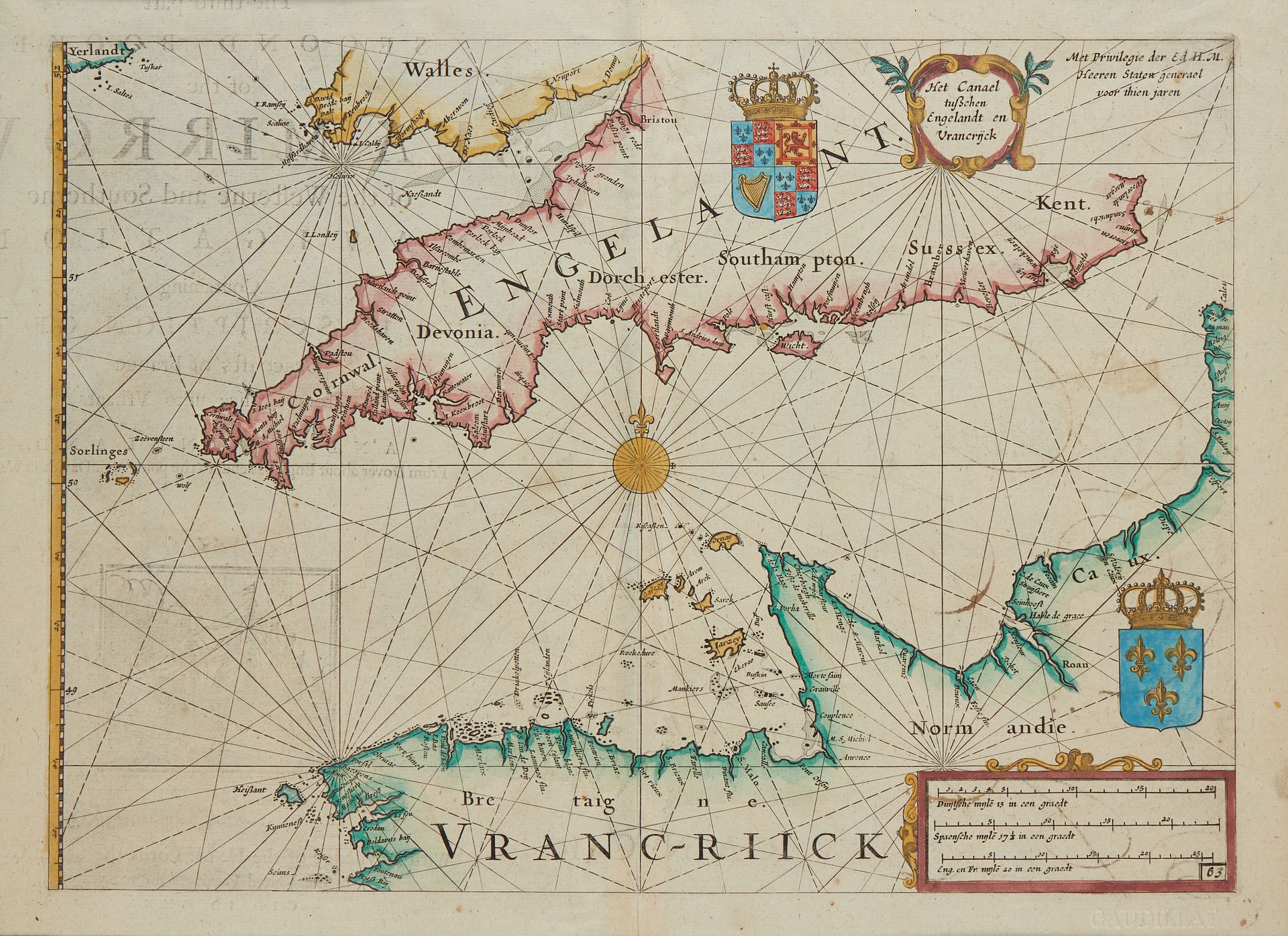
BLAEU, G. Het Canael tuschen Engelandt en Vrancreick. Amsterdam, 1608-1635. Col. Text on verso visible in transparency. 259 x 359 mm. Rare nautical chart of the English Channel by Guillaume (Jansson) Blaeu from the second book of the Sea Mirrour, 1635, as attested by the title page on the reverse of the map in its English version, without giving the name of the author. This map, like some others afterwards, shows us a part of the Breton coast such as the navigators could see it. What is striking at first sight is the "flap" of the observation, it is the "planing" of the sector Perros-Guirec/Tréguier. Then, it is the very characteristic shape of the Cotentin peninsula, a shape that will be repeated several times thereafter. Two coats of arms, French and English. § Copy reproduced in Anciennes Cartes Marines de la Bretagne 1580-1800, Pl. N°4.
45
BLAEU, G. Het Canael tuschen Engelandt en Vrancreick. Amsterdam, 1608-1635. Col. Text on verso visible in transparency. 259 x 359 mm. Rare nautical chart of the English Channel by Guillaume (Jansson) Blaeu from the second book of the Sea Mirrour, 1635, as attested by the title page on the reverse of the map in its English version, without giving the name of the author. This map, like some others afterwards, shows us a part of the Breton coast such as the navigators could see it. What is striking at first sight is the "flap" of the observation, it is the "planing" of the sector Perros-Guirec/Tréguier. Then, it is the very characteristic shape of the Cotentin peninsula, a shape that will be repeated several times thereafter. Two coats of arms, French and English. § Copy reproduced in Anciennes Cartes Marines de la Bretagne 1580-1800, Pl. N°4.