Description
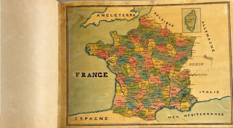
ATLAS. ANCIENT PROVINCES OF FRANCE. Manuscript illustrated with watercolor drawings. No place, mid-19th century; in-4 (220 x 305 mm) of 92 pages, hardback. Atlas of France handwritten and drawn by an anonymous author in the mid-19th century (Alsace and Lorraine are part of the territory). The text provides information on geography, economy, climate, provinces and resources of the country, etc. There are 57 maps of France by provinces, regions, departments, geology, agricultural resources, vineyards, etc., etc. Very neatly executed.
16
ATLAS. ANCIENT PROVINCES OF FRANCE. Manuscript illustrated with watercolor drawings. No place, mid-19th century; in-4 (220 x 305 mm) of 92 pages, hardback. Atlas of France handwritten and drawn by an anonymous author in the mid-19th century (Alsace and Lorraine are part of the territory). The text provides information on geography, economy, climate, provinces and resources of the country, etc. There are 57 maps of France by provinces, regions, departments, geology, agricultural resources, vineyards, etc., etc. Very neatly executed.