JEFFERYS, Thomas.
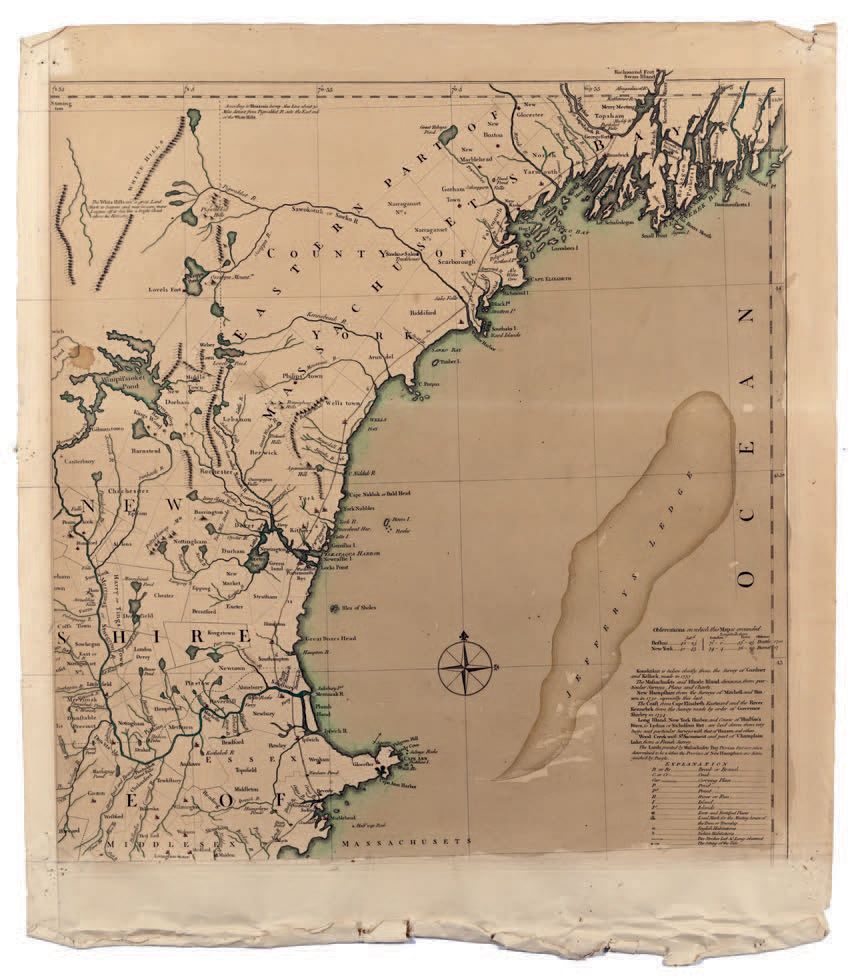
Map on 3 sheets (of 4), missing the upper left part. On strong laid paper with unidentified watermark. Paper browned. Sea and coasts orig. coloured in green and cities in red.
Map separately issued, drawn by Braddock Mead, alias John Green. The map contains two highly-detailed cartographic insets, one of the city of Boston (upper-left) (sheet missing), and another of Boston Harbor on the lower-right sheet. The map is also decorated with a pictorial title cartouche, depicting the arrival of the Pilgrims at Plymouth Rock in 1620. Here with the spelling of Konektikut changed in Connecticut.
The largest and most detailed map of New England that had yet been published, and one of the great maps of the east coast of America, by one of the greatest figures in 18th-century cartography: "Mead's contributions to cartography stand out ... At a time when the quality and the ethics of map production were at a low ebb in England, he vigorously urged and practiced the highest standards" (Cumming).
- McCorkle, New England in Early Printed Maps, 755.19 (first edition/state);Sellers & Van Ee, Maps & Charts of North America & West Indies, 799; Osher map library, Publication History and Images of the “Map of the most Inhabited Part of New England.