描述
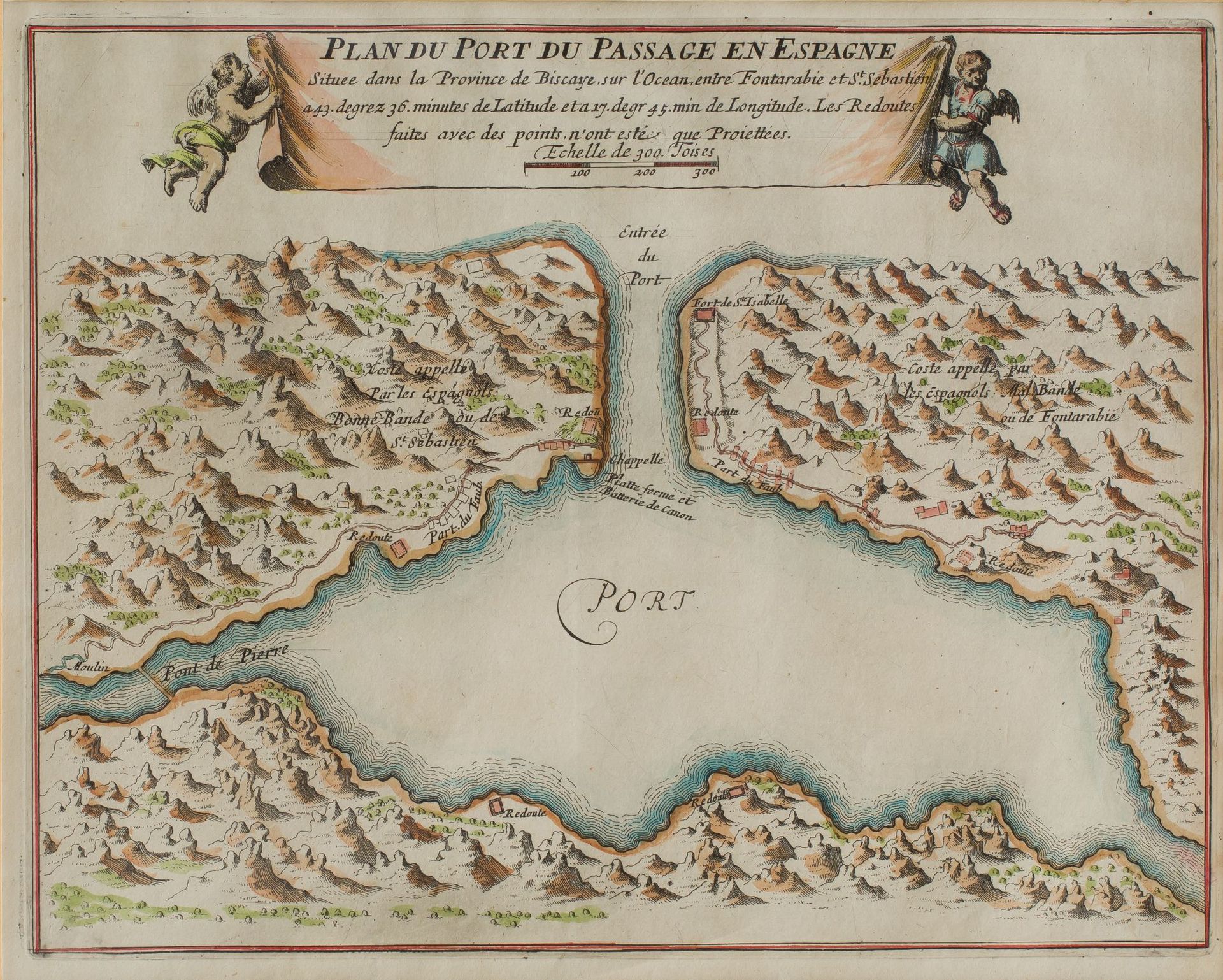
NICOLAS DE FER (1646 / 1720) "Map of the ports of Pasajes and Fuenterrabía"
PLAN DEL PUERTO DE PASAJES/PASAIAPLAN DU PORT DU PASSAGE .... FONTARABIA和St. SEBASTIAN之间..."。巴黎1693年。(HONDARRIBIA)。FONTARABIA,海港......和西班牙比斯开省的城墙......在Bidasoa的小河上。Inselin fecit.Paris ca 1700 .para la obra de N. de Fer : Les Forces de L'Europe, Asie, ... ou description des principales villes avec leurs fortifications...A Paris chez l'auteur, 1693/1700 .一对彩色版画。22 x 29 厘米。
511
NICOLAS DE FER (1646 / 1720) "Map of the ports of Pasajes and Fuenterrabía"