Descrizione
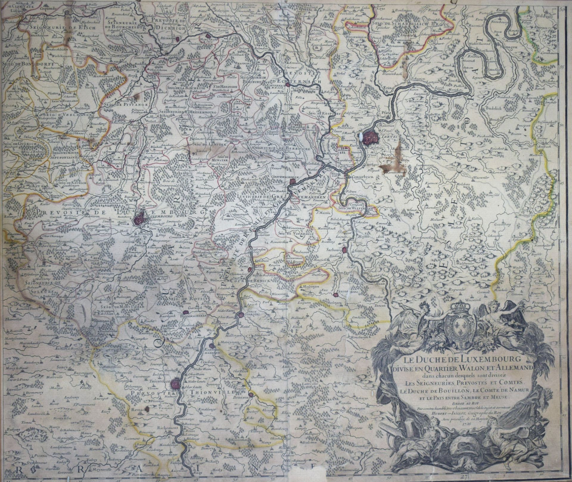
(MAPPA) Carta geografica antica leggermente acquerellata "Il Ducato di Lussemburgo diviso in quartieri gallonici e tedeschi" di Charles-Hubert-Alexis JAILLOT, 1736, carta strappata e mancante in basso al centro, 54 x 53 cm (in visione) [Van Der Vekene - Les cartes géographiques du Duché de Luxembourg - 2.32.E].
641
(MAPPA) Carta geografica antica leggermente acquerellata "Il Ducato di Lussemburgo diviso in quartieri gallonici e tedeschi" di Charles-Hubert-Alexis JAILLOT, 1736, carta strappata e mancante in basso al centro, 54 x 53 cm (in visione) [Van Der Vekene - Les cartes géographiques du Duché de Luxembourg - 2.32.E].