Description
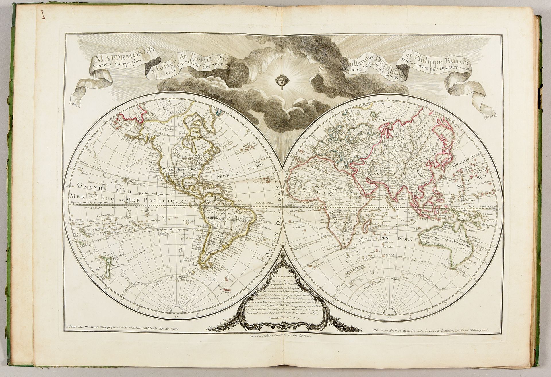
Composite atlas. Late 18th-early 19th c Large folio: 22 engr. maps, 18 with col. borders (fold underl. of "Orbis veteribus", marg. of d'Anville maps sl. soiled, some sm. marg. spots). 19th-c. cased binding (used). Interesting composite atlas with 16 maps from "Atlas geographique" by Dezauche, based on Guillaume Delisle and Philippe Buache: world map, Europe, Asia, Africa, America, France, France in new division, Southern Low Countries, Dutch Republic, Switzerland, Germany, Italy, Poland, Spain, British Isles and Greece. And 6 maps by J.-B. Bourguignon d'Anville: the ancient World, Western part of the Roman Empire, Eastern part of the Roman Empire, Gaul, Ancient Italy and Ancient Greece.
570
Composite atlas. Late 18th-early 19th c Large folio: 22 engr. maps, 18 with col. borders (fold underl. of "Orbis veteribus", marg. of d'Anville maps sl. soiled, some sm. marg. spots). 19th-c. cased binding (used). Interesting composite atlas with 16 maps from "Atlas geographique" by Dezauche, based on Guillaume Delisle and Philippe Buache: world map, Europe, Asia, Africa, America, France, France in new division, Southern Low Countries, Dutch Republic, Switzerland, Germany, Italy, Poland, Spain, British Isles and Greece. And 6 maps by J.-B. Bourguignon d'Anville: the ancient World, Western part of the Roman Empire, Eastern part of the Roman Empire, Gaul, Ancient Italy and Ancient Greece.