Description
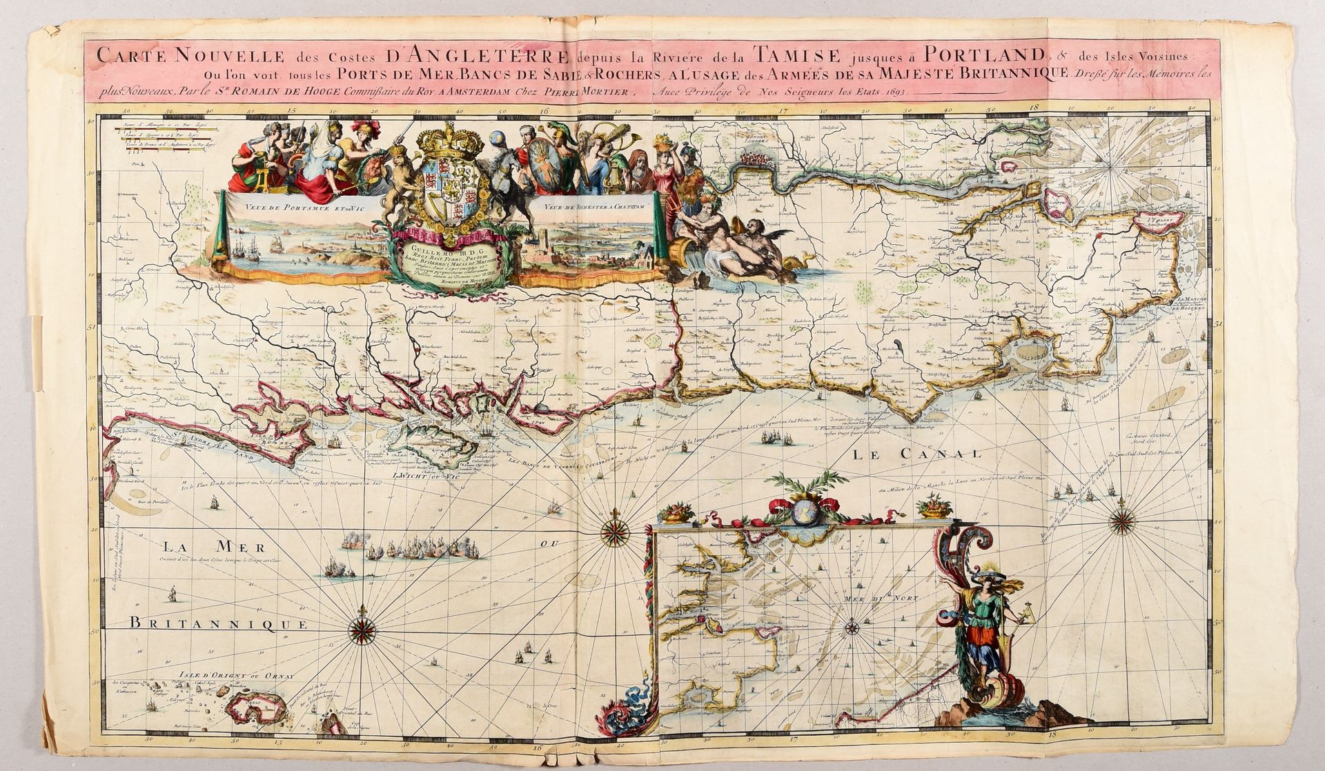
DE HOOGHE, Romeyn Carte nouvelle des costes d'Angleterre depuis la rivière de la Tamise jusques à Portland [...]. Amsterdam P. Mortier 1693 Engr., 58 x 95 cm, hand-coloured (traces of folds, sm. tears in lower edge, outer edges sl. toned). Large nautical chart of England, showing the mouth of the Thames and the city of London. With a beautiful, allegorical cartouche, 2 inset views (Portsmouth and the Isle of Wight, Rochester and Chatham) and an inset map of the Strait of Dover within an ornamental frame. One of the 9 charts from the "Atlas maritime [...]" by Mortier, the continuation of the "Neptune François". Ref. Koeman M.Mor 5 (6).
537
DE HOOGHE, Romeyn Carte nouvelle des costes d'Angleterre depuis la rivière de la Tamise jusques à Portland [...]. Amsterdam P. Mortier 1693 Engr., 58 x 95 cm, hand-coloured (traces of folds, sm. tears in lower edge, outer edges sl. toned). Large nautical chart of England, showing the mouth of the Thames and the city of London. With a beautiful, allegorical cartouche, 2 inset views (Portsmouth and the Isle of Wight, Rochester and Chatham) and an inset map of the Strait of Dover within an ornamental frame. One of the 9 charts from the "Atlas maritime [...]" by Mortier, the continuation of the "Neptune François". Ref. Koeman M.Mor 5 (6).