Description
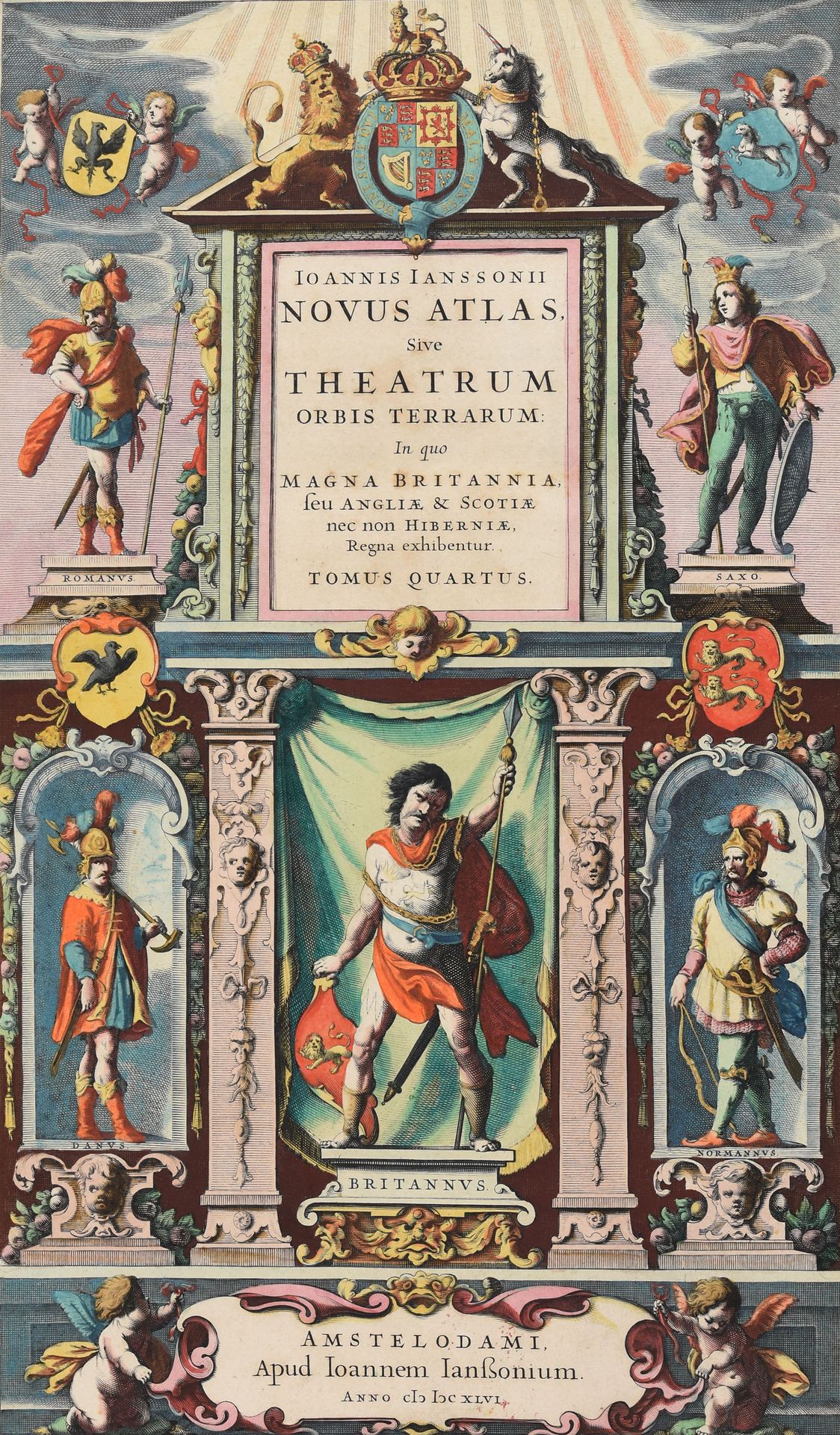
JANSSONIUS, Johannes Novus atlas sive Theatrum orbis terrarum in quo Magna Britannia, seu Angliae & Scotiae nec non Hiberniae regna exhibentur. Tomus Quartus. Amsterdam J. Janssonius 1646 Large folio: [8]-364-50-[1] pp.; 56 maps, nice contemp. hand-colouring (wormhole in margin title, maps: Antique maps of the British Isles: folded (n. 1) or centr. fold. split in margin (n. 3), idem for the map of Sussex (n. 6), marg. tear in the map of Somerset (n. 10); text: tear in corner p. 63, undulating p. 195, large tear p. 309, some spots and damp stains throughout). Contemp. vellum, gilt decorated covers with central medallion, flat spine (hinges broken, corners bumped, edges worn, a bit soiled). Complete Latin edition of Janssonius' atlas of the British Isles. The volume was the 4th part of the 1647 edition of his Atlas Novus. With an engr. architectural title and 56 double-page engraved regional and county maps, and with sm. engr. or woodcuts in the text illustrating Stonehenge, a stone circle, subterranean tombs and monuments. Folio 3F: "Middelsexiae cum Hertfordiae comitatu" is pasted over another map, as is the case in the copies of London and Toulouse described by van der Krogt. Ref. van der Krogt I[1:403.4I]. Prov. "Peelaert 1796" (handwritten ownership's entry).
566
JANSSONIUS, Johannes Novus atlas sive Theatrum orbis terrarum in quo Magna Britannia, seu Angliae & Scotiae nec non Hiberniae regna exhibentur. Tomus Quartus. Amsterdam J. Janssonius 1646 Large folio: [8]-364-50-[1] pp.; 56 maps, nice contemp. hand-colouring (wormhole in margin title, maps: Antique maps of the British Isles: folded (n. 1) or centr. fold. split in margin (n. 3), idem for the map of Sussex (n. 6), marg. tear in the map of Somerset (n. 10); text: tear in corner p. 63, undulating p. 195, large tear p. 309, some spots and damp stains throughout). Contemp. vellum, gilt decorated covers with central medallion, flat spine (hinges broken, corners bumped, edges worn, a bit soiled). Complete Latin edition of Janssonius' atlas of the British Isles. The volume was the 4th part of the 1647 edition of his Atlas Novus. With an engr. architectural title and 56 double-page engraved regional and county maps, and with sm. engr. or woodcuts in the text illustrating Stonehenge, a stone circle, subterranean tombs and monuments. Folio 3F: "Middelsexiae cum Hertfordiae comitatu" is pasted over another map, as is the case in the copies of London and Toulouse described by van der Krogt. Ref. van der Krogt I[1:403.4I]. Prov. "Peelaert 1796" (handwritten ownership's entry).